
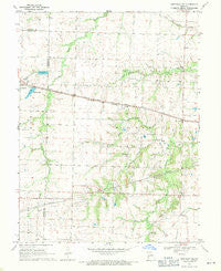
~ Centralia NE MO topo map, 1:24000 scale, 7.5 X 7.5 Minute, Historical, 1969, updated 1971
Centralia NE, Missouri, USGS topographic map dated 1969.
Includes geographic coordinates (latitude and longitude). This topographic map is suitable for hiking, camping, and exploring, or framing it as a wall map.
Printed on-demand using high resolution imagery, on heavy weight and acid free paper, or alternatively on a variety of synthetic materials.
Topos available on paper, Waterproof, Poly, or Tyvek. Usually shipping rolled, unless combined with other folded maps in one order.
- Product Number: USGS-5576832
- Free digital map download (high-resolution, GeoPDF): Centralia NE, Missouri (file size: 10 MB)
- Map Size: please refer to the dimensions of the GeoPDF map above
- Weight (paper map): ca. 55 grams
- Map Type: POD USGS Topographic Map
- Map Series: HTMC
- Map Verison: Historical
- Cell ID: 7986
- Scan ID: 322251
- Imprint Year: 1971
- Woodland Tint: Yes
- Aerial Photo Year: 1967
- Field Check Year: 1969
- Datum: NAD27
- Map Projection: Polyconic
- Map published by United States Geological Survey
- Map Language: English
- Scanner Resolution: 600 dpi
- Map Cell Name: Centralia NE
- Grid size: 7.5 X 7.5 Minute
- Date on map: 1969
- Map Scale: 1:24000
- Geographical region: Missouri, United States
Neighboring Maps:
All neighboring USGS topo maps are available for sale online at a variety of scales.
Spatial coverage:
Topo map Centralia NE, Missouri, covers the geographical area associated the following places:
- Kon-Tiki Reservoir - German Cemetery - Wabash Lake Dam - Shellabarger Dam South - New Hope Church - Mayes Creek - Township of Wilson - Shellabarger Dam North - Gant - Skull Lick School (historical) - High Hill School (historical) - Daniel School (historical) - Harrison School (historical) - Highland School (historical) - Little Dixie Fire Protection District Station 3 - Payne School (historical) - Shellabarger Lake Dam - Salisbury Lake Dam - Gant School (historical) - Wabash Lake - Schnarre-Ridder Lake Dam - Possum Walk Creek - Salt River Church - Gallaway Lake Dam - Liberty Church - Pleasant Green School (historical) - Bay Lake Dam - Skull Lick Cemetery
- Map Area ID: AREA39.2539.125-92.125-92
- Northwest corner Lat/Long code: USGSNW39.25-92.125
- Northeast corner Lat/Long code: USGSNE39.25-92
- Southwest corner Lat/Long code: USGSSW39.125-92.125
- Southeast corner Lat/Long code: USGSSE39.125-92
- Northern map edge Latitude: 39.25
- Southern map edge Latitude: 39.125
- Western map edge Longitude: -92.125
- Eastern map edge Longitude: -92


