
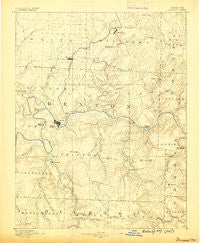
~ Warsaw MO topo map, 1:125000 scale, 30 X 30 Minute, Historical, 1887
Warsaw, Missouri, USGS topographic map dated 1887.
Includes geographic coordinates (latitude and longitude). This topographic map is suitable for hiking, camping, and exploring, or framing it as a wall map.
Printed on-demand using high resolution imagery, on heavy weight and acid free paper, or alternatively on a variety of synthetic materials.
Topos available on paper, Waterproof, Poly, or Tyvek. Usually shipping rolled, unless combined with other folded maps in one order.
- Product Number: USGS-5575850
- Free digital map download (high-resolution, GeoPDF): Warsaw, Missouri (file size: 6 MB)
- Map Size: please refer to the dimensions of the GeoPDF map above
- Weight (paper map): ca. 55 grams
- Map Type: POD USGS Topographic Map
- Map Series: HTMC
- Map Verison: Historical
- Cell ID: 66889
- Scan ID: 325583
- Survey Year: 1885
- Datum: Unstated
- Map Projection: Unstated
- Map published by United States Geological Survey
- Map Language: English
- Scanner Resolution: 600 dpi
- Map Cell Name: Warsaw
- Grid size: 30 X 30 Minute
- Date on map: 1887
- Map Scale: 1:125000
- Geographical region: Missouri, United States
Neighboring Maps:
All neighboring USGS topo maps are available for sale online at a variety of scales.
Spatial coverage:
Topo map Warsaw, Missouri, covers the geographical area associated the following places:
- Avery - Lively - Tackner - Cole Camp Junction - Crest - Cross Timbers - Warsaw - Cole Camp - Racket - Cold Springs - Majorville - Palo Pinto - Valley View - Knobby - Dell Junction - Climax Springs - Teal Bend - Lincoln - Boylers Mill - Fairfield (historical) - White Cloud - Phillips Ford (historical) - Zora - Gabriels Mills - Lakeview Heights - Quincy - Macks Camp - Hilda - Bentonville - Pom-o-sa Heights - Riverview - Dell - Hastain - Jordan - White Branch - Round Bottom Ford (historical) - Big Bend Acres - Edmonson - Opportunity Farms - Crittenden (historical) - Crockerville - Santiago - Wisdom - Blue Branch - Fristoe - Edwards - Walkers Corner - Sagrada - Whitakerville
- Map Area ID: AREA38.538-93.5-93
- Northwest corner Lat/Long code: USGSNW38.5-93.5
- Northeast corner Lat/Long code: USGSNE38.5-93
- Southwest corner Lat/Long code: USGSSW38-93.5
- Southeast corner Lat/Long code: USGSSE38-93
- Northern map edge Latitude: 38.5
- Southern map edge Latitude: 38
- Western map edge Longitude: -93.5
- Eastern map edge Longitude: -93


