
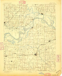
~ Marshall MO topo map, 1:125000 scale, 30 X 30 Minute, Historical, 1892, updated 1896
Marshall, Missouri, USGS topographic map dated 1892.
Includes geographic coordinates (latitude and longitude). This topographic map is suitable for hiking, camping, and exploring, or framing it as a wall map.
Printed on-demand using high resolution imagery, on heavy weight and acid free paper, or alternatively on a variety of synthetic materials.
Topos available on paper, Waterproof, Poly, or Tyvek. Usually shipping rolled, unless combined with other folded maps in one order.
- Product Number: USGS-5575700
- Free digital map download (high-resolution, GeoPDF): Marshall, Missouri (file size: 6 MB)
- Map Size: please refer to the dimensions of the GeoPDF map above
- Weight (paper map): ca. 55 grams
- Map Type: POD USGS Topographic Map
- Map Series: HTMC
- Map Verison: Historical
- Cell ID: 65997
- Scan ID: 325508
- Imprint Year: 1896
- Survey Year: 1887
- Datum: Unstated
- Map Projection: Unstated
- Map published by United States Geological Survey
- Map Language: English
- Scanner Resolution: 600 dpi
- Map Cell Name: Marshall
- Grid size: 30 X 30 Minute
- Date on map: 1892
- Map Scale: 1:125000
- Geographical region: Missouri, United States
Neighboring Maps:
All neighboring USGS topo maps are available for sale online at a variety of scales.
Spatial coverage:
Topo map Marshall, Missouri, covers the geographical area associated the following places:
- Little Osage Village (historical) - Grand Pass - South Carrollton - Blosser (historical) - Mount Leonard - Miami - Blackburn - Missouri Village (historical) - Sharon - Grand Port - Malta Bend - Wilton Springs - Hardeman - Gilliam - Standish - Milford - Brunswick - Elmwood - Herndon - Leta - Marshall - Wakenda - Blue Lick - Slater - Shackleford - Carrollton - Fairville - Salt Springs - Bosworth - White Rock - Norton - Cretcher - Napton - Montague Hill - New Frankfort - Triplett - De Witt - Orearville - Stanhope - Grand River City (historical)
- Map Area ID: AREA39.539-93.5-93
- Northwest corner Lat/Long code: USGSNW39.5-93.5
- Northeast corner Lat/Long code: USGSNE39.5-93
- Southwest corner Lat/Long code: USGSSW39-93.5
- Southeast corner Lat/Long code: USGSSE39-93
- Northern map edge Latitude: 39.5
- Southern map edge Latitude: 39
- Western map edge Longitude: -93.5
- Eastern map edge Longitude: -93


