
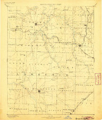
~ Greenfield MO topo map, 1:125000 scale, 30 X 30 Minute, Historical, 1886, updated 1905
Greenfield, Missouri, USGS topographic map dated 1886.
Includes geographic coordinates (latitude and longitude). This topographic map is suitable for hiking, camping, and exploring, or framing it as a wall map.
Printed on-demand using high resolution imagery, on heavy weight and acid free paper, or alternatively on a variety of synthetic materials.
Topos available on paper, Waterproof, Poly, or Tyvek. Usually shipping rolled, unless combined with other folded maps in one order.
- Product Number: USGS-5575626
- Free digital map download (high-resolution, GeoPDF): Greenfield, Missouri (file size: 6 MB)
- Map Size: please refer to the dimensions of the GeoPDF map above
- Weight (paper map): ca. 55 grams
- Map Type: POD USGS Topographic Map
- Map Series: HTMC
- Map Verison: Historical
- Cell ID: 65605
- Scan ID: 325460
- Imprint Year: 1905
- Survey Year: 1884
- Datum: Unstated
- Map Projection: Unstated
- Map published by United States Geological Survey
- Map Language: English
- Scanner Resolution: 600 dpi
- Map Cell Name: Greenfield
- Grid size: 30 X 30 Minute
- Date on map: 1886
- Map Scale: 1:125000
- Geographical region: Missouri, United States
Neighboring Maps:
All neighboring USGS topo maps are available for sale online at a variety of scales.
Spatial coverage:
Topo map Greenfield, Missouri, covers the geographical area associated the following places:
- South Greenfield - Ash Grove - Billings - Grays Point - Gaither (historical) - Chesapeake - Pilgrim - Knox - Stinson - Dadeville - Lockwood - Olinger - Halltown - Yeakley - Phelps - Opal - Comet - Hulston - Albatross - Kings Point - Grays Valley - Corry - Plano - Harold - Everton - Emmett (historical) - Heatonville - Greenfield - Landrum - McKinley - Bois D'Arc - Orange - Call - Fiddlers Ford - Spencer - Eudora - Logan - Dilday Mill - Phenix - Hoberg - Stotts City - Pennsboro - Snadon Ford - Graydon Springs - Walnut Grove - Buckley (historical) - Marionville - Paris Springs - Meinert - Elliott - Lawrenceburg - Miller - Nickelville - Rescue - Sims Point - Freistatt - Mount Vernon - New Kirk - Turnback (historical) - Round Grove
- Map Area ID: AREA37.537-94-93.5
- Northwest corner Lat/Long code: USGSNW37.5-94
- Northeast corner Lat/Long code: USGSNE37.5-93.5
- Southwest corner Lat/Long code: USGSSW37-94
- Southeast corner Lat/Long code: USGSSE37-93.5
- Northern map edge Latitude: 37.5
- Southern map edge Latitude: 37
- Western map edge Longitude: -94
- Eastern map edge Longitude: -93.5


