
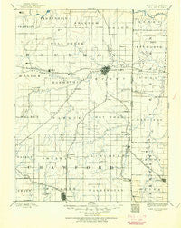
~ Fort Scott KS topo map, 1:125000 scale, 30 X 30 Minute, Historical, 1884, updated 1954
Fort Scott, Kansas, USGS topographic map dated 1884.
Includes geographic coordinates (latitude and longitude). This topographic map is suitable for hiking, camping, and exploring, or framing it as a wall map.
Printed on-demand using high resolution imagery, on heavy weight and acid free paper, or alternatively on a variety of synthetic materials.
Topos available on paper, Waterproof, Poly, or Tyvek. Usually shipping rolled, unless combined with other folded maps in one order.
- Product Number: USGS-5575598
- Free digital map download (high-resolution, GeoPDF): Fort Scott, Kansas (file size: 5 MB)
- Map Size: please refer to the dimensions of the GeoPDF map above
- Weight (paper map): ca. 55 grams
- Map Type: POD USGS Topographic Map
- Map Series: HTMC
- Map Verison: Historical
- Cell ID: 65509
- Scan ID: 325448
- Imprint Year: 1954
- Survey Year: 1884
- Datum: Unstated
- Map Projection: Unstated
- Map published by United States Geological Survey
- Map Language: English
- Scanner Resolution: 600 dpi
- Map Cell Name: Fort Scott
- Grid size: 30 X 30 Minute
- Date on map: 1884
- Map Scale: 1:125000
- Geographical region: Kansas, United States
Neighboring Maps:
All neighboring USGS topo maps are available for sale online at a variety of scales.
Spatial coverage:
Topo map Fort Scott, Kansas, covers the geographical area associated the following places:
- Devon - Englevale - Bunnville (historical) - Redfield - Hollister - Fuller - Godfrey - Hiattville - Gross - Farlington - Brazilton - Ronald - Arcadia - Mulberry - Hammond - Barber - Swart - Uniontown - Fox Town - Ringo - Polk - Ardath - Miller Brothers (historical) - Pawnee Station - Girard - Burgess - Franklin - Edison - Richards - Red Onion - Edward - Greenbush - Curranville - Stotesbury - Garland - Eve - Deerfield - Mertz - Katy - Petersburg - Xenia - Marmaton - Cato - Liberal - Oskaloosa - Hepler - Dry Wood - Harding - Berlin - Fort Scott - Arma - Croweburg - Coalvale
- Map Area ID: AREA3837.5-95-94.5
- Northwest corner Lat/Long code: USGSNW38-95
- Northeast corner Lat/Long code: USGSNE38-94.5
- Southwest corner Lat/Long code: USGSSW37.5-95
- Southeast corner Lat/Long code: USGSSE37.5-94.5
- Northern map edge Latitude: 38
- Southern map edge Latitude: 37.5
- Western map edge Longitude: -95
- Eastern map edge Longitude: -94.5


