
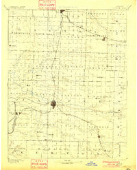
~ Carthage MO topo map, 1:125000 scale, 30 X 30 Minute, Historical, 1894, updated 1901
Carthage, Missouri, USGS topographic map dated 1894.
Includes geographic coordinates (latitude and longitude). This topographic map is suitable for hiking, camping, and exploring, or framing it as a wall map.
Printed on-demand using high resolution imagery, on heavy weight and acid free paper, or alternatively on a variety of synthetic materials.
Topos available on paper, Waterproof, Poly, or Tyvek. Usually shipping rolled, unless combined with other folded maps in one order.
- Product Number: USGS-5575566
- Free digital map download (high-resolution, GeoPDF): Carthage, Missouri (file size: 5 MB)
- Map Size: please refer to the dimensions of the GeoPDF map above
- Weight (paper map): ca. 55 grams
- Map Type: POD USGS Topographic Map
- Map Series: HTMC
- Map Verison: Historical
- Cell ID: 65146
- Scan ID: 325433
- Imprint Year: 1901
- Survey Year: 1884
- Datum: Unstated
- Map Projection: Unstated
- Map published by United States Geological Survey
- Map Language: English
- Scanner Resolution: 600 dpi
- Map Cell Name: Carthage
- Grid size: 30 X 30 Minute
- Date on map: 1894
- Map Scale: 1:125000
- Geographical region: Missouri, United States
Neighboring Maps:
All neighboring USGS topo maps are available for sale online at a variety of scales.
Spatial coverage:
Topo map Carthage, Missouri, covers the geographical area associated the following places:
- Golden City - Avilla - Purcell - Sarcoxie - Dudenville - Plew - Kenoma - Oakton - Tuckers Corner - Webb City - Layneville - Knights - Prosperity - Bushnell - Saginaw - Davenport - Fidelity - Jasper - Motley - Forest Mills - Scotland - Atlas - Boston - Duenweg - Morgan Heights - Sherwood (historical) - Talmage City - Carthage - Lamar - Carytown - Dry Valley - Red Oak - Leawood - East Joplin - La Russell - Reeds - Neck City - Kendricktown - Lamar Heights - Malty - Lakeside - Brooklyn Heights - Pepsin - Bowers Mill - Preston - Oronogo - Clarkson - Shoal Creek Estates - Pleasant Valley - Cossville - Gateway Drive - Sunnyvale - Esrom - Maxville - Nashville - Parshley - Rex City - Oakland Park - Maple Grove - Carterville - Duquesne - Alba - Silver Creek
- Map Area ID: AREA37.537-94.5-94
- Northwest corner Lat/Long code: USGSNW37.5-94.5
- Northeast corner Lat/Long code: USGSNE37.5-94
- Southwest corner Lat/Long code: USGSSW37-94.5
- Southeast corner Lat/Long code: USGSSE37-94
- Northern map edge Latitude: 37.5
- Southern map edge Latitude: 37
- Western map edge Longitude: -94.5
- Eastern map edge Longitude: -94


