
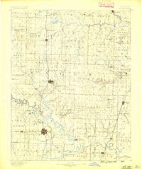
~ Butler MO topo map, 1:125000 scale, 30 X 30 Minute, Historical, 1887
Butler, Missouri, USGS topographic map dated 1887.
Includes geographic coordinates (latitude and longitude). This topographic map is suitable for hiking, camping, and exploring, or framing it as a wall map.
Printed on-demand using high resolution imagery, on heavy weight and acid free paper, or alternatively on a variety of synthetic materials.
Topos available on paper, Waterproof, Poly, or Tyvek. Usually shipping rolled, unless combined with other folded maps in one order.
- Product Number: USGS-5575548
- Free digital map download (high-resolution, GeoPDF): Butler, Missouri (file size: 6 MB)
- Map Size: please refer to the dimensions of the GeoPDF map above
- Weight (paper map): ca. 55 grams
- Map Type: POD USGS Topographic Map
- Map Series: HTMC
- Map Verison: Historical
- Cell ID: 65090
- Scan ID: 325424
- Survey Year: 1885
- Datum: Unstated
- Map Projection: Unstated
- Map published by United States Geological Survey
- Map Language: English
- Scanner Resolution: 600 dpi
- Map Cell Name: Butler
- Grid size: 30 X 30 Minute
- Date on map: 1887
- Map Scale: 1:125000
- Geographical region: Missouri, United States
Neighboring Maps:
All neighboring USGS topo maps are available for sale online at a variety of scales.
Spatial coverage:
Topo map Butler, Missouri, covers the geographical area associated the following places:
- Main City - Mayesburg - Lacyville - Schell City - Passaic - Monteith Junction - Crescent Hill - Spruce - Urich - Germantown - Altona - Hudson - New Piper - Panama - Aaron - Lucas - Virginia - Papinville - Indian Springs - Athol - Creighton - Pleasant Gap - Sprague - Dayton - Piper - Reynard (historical) - Butler - Lindale - Adrian - New Home - Burdett - Arthur - Cornland - Johnstown - Prairie City - Nyhart - Carbon Center - Appleton City - Archie - Rich Hill - Rocky Ford (historical) - Rockville - Coleville - Ballard - Peru (historical)
- Map Area ID: AREA38.538-94.5-94
- Northwest corner Lat/Long code: USGSNW38.5-94.5
- Northeast corner Lat/Long code: USGSNE38.5-94
- Southwest corner Lat/Long code: USGSSW38-94.5
- Southeast corner Lat/Long code: USGSSE38-94
- Northern map edge Latitude: 38.5
- Southern map edge Latitude: 38
- Western map edge Longitude: -94.5
- Eastern map edge Longitude: -94


