
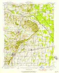
~ Bloomfield MO topo map, 1:62500 scale, 15 X 15 Minute, Historical, 1949, updated 1958
Bloomfield, Missouri, USGS topographic map dated 1949.
Includes geographic coordinates (latitude and longitude). This topographic map is suitable for hiking, camping, and exploring, or framing it as a wall map.
Printed on-demand using high resolution imagery, on heavy weight and acid free paper, or alternatively on a variety of synthetic materials.
Topos available on paper, Waterproof, Poly, or Tyvek. Usually shipping rolled, unless combined with other folded maps in one order.
- Product Number: USGS-5574360
- Free digital map download (high-resolution, GeoPDF): Bloomfield, Missouri (file size: 8 MB)
- Map Size: please refer to the dimensions of the GeoPDF map above
- Weight (paper map): ca. 55 grams
- Map Type: POD USGS Topographic Map
- Map Series: HTMC
- Map Verison: Historical
- Cell ID: 51530
- Scan ID: 324730
- Imprint Year: 1958
- Woodland Tint: Yes
- Survey Year: 1931
- Datum: NAD27
- Map Projection: Polyconic
- Map published by United States Geological Survey
- Map published by United States Army Corps of Engineers
- Map Language: English
- Scanner Resolution: 600 dpi
- Map Cell Name: Bloomfield
- Grid size: 15 X 15 Minute
- Date on map: 1949
- Map Scale: 1:62500
- Geographical region: Missouri, United States
Neighboring Maps:
All neighboring USGS topo maps are available for sale online at a variety of scales.
Spatial coverage:
Topo map Bloomfield, Missouri, covers the geographical area associated the following places:
- Frisco - Zadock - Guam - Bloomfield - Penermon - Baker - Dexter - Shawan - Birds Corner - Shady Dell - Aquilla - Avert - Idalia - Grayridge - Durnell - Essex - Old Shawnee Village (historical) - Circle City - Hunterville - Clines Island - Toppertown - Zeta (historical) - Himmel
- Map Area ID: AREA3736.75-90-89.75
- Northwest corner Lat/Long code: USGSNW37-90
- Northeast corner Lat/Long code: USGSNE37-89.75
- Southwest corner Lat/Long code: USGSSW36.75-90
- Southeast corner Lat/Long code: USGSSE36.75-89.75
- Northern map edge Latitude: 37
- Southern map edge Latitude: 36.75
- Western map edge Longitude: -90
- Eastern map edge Longitude: -89.75


