
~ Preston Reservoir NV topo map, 1:62500 scale, 15 X 15 Minute, Historical, 1959, updated 1961
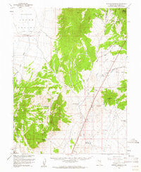
Preston Reservoir, Nevada, USGS topographic map dated 1959.
Includes geographic coordinates (latitude and longitude). This topographic map is suitable for hiking, camping, and exploring, or framing it as a wall map.
Printed on-demand using high resolution imagery, on heavy weight and acid free paper, or alternatively on a variety of synthetic materials.
Topos available on paper, Waterproof, Poly, or Tyvek. Usually shipping rolled, unless combined with other folded maps in one order.
- Product Number: USGS-5573026
- Free digital map download (high-resolution, GeoPDF): Preston Reservoir, Nevada (file size: 7 MB)
- Map Size: please refer to the dimensions of the GeoPDF map above
- Weight (paper map): ca. 55 grams
- Map Type: POD USGS Topographic Map
- Map Series: HTMC
- Map Verison: Historical
- Cell ID: 61289
- Scan ID: 321202
- Imprint Year: 1961
- Woodland Tint: Yes
- Aerial Photo Year: 1956
- Field Check Year: 1959
- Datum: NAD27
- Map Projection: Polyconic
- Map published by United States Geological Survey
- Map Language: English
- Scanner Resolution: 600 dpi
- Map Cell Name: Preston Reservoir
- Grid size: 15 X 15 Minute
- Date on map: 1959
- Map Scale: 1:62500
- Geographical region: Nevada, United States
Neighboring Maps:
All neighboring USGS topo maps are available for sale online at a variety of scales.
Spatial coverage:
Topo map Preston Reservoir, Nevada, covers the geographical area associated the following places:
- Jakes Wash Well - Giroux Wash - Circle Wash - Giroux Wash Reservoir - Sierra Valley - Gubler Wash - Railroad Crossing Dam - Blackjack Springs - Preston Seeding Windmill - White River Wash - Dark Peak - Deadman Gulch Reservoir - Holt Creek - Holt Camp Creek - Rib Hill - Lion Spring Wash - Hayden Creek - White Sage Wash - Ely Reservation - Rowe Creek - Preston Dam - Preston Reservoir - Deadman Wash - Midway Well - Dead Horse Wash
- Map Area ID: AREA39.2539-115.25-115
- Northwest corner Lat/Long code: USGSNW39.25-115.25
- Northeast corner Lat/Long code: USGSNE39.25-115
- Southwest corner Lat/Long code: USGSSW39-115.25
- Southeast corner Lat/Long code: USGSSE39-115
- Northern map edge Latitude: 39.25
- Southern map edge Latitude: 39
- Western map edge Longitude: -115.25
- Eastern map edge Longitude: -115


