
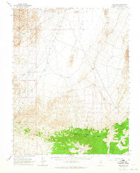
~ Lida Wash NV topo map, 1:62500 scale, 15 X 15 Minute, Historical, 1963, updated 1965
Lida Wash, Nevada, USGS topographic map dated 1963.
Includes geographic coordinates (latitude and longitude). This topographic map is suitable for hiking, camping, and exploring, or framing it as a wall map.
Printed on-demand using high resolution imagery, on heavy weight and acid free paper, or alternatively on a variety of synthetic materials.
Topos available on paper, Waterproof, Poly, or Tyvek. Usually shipping rolled, unless combined with other folded maps in one order.
- Product Number: USGS-5572746
- Free digital map download (high-resolution, GeoPDF): Lida Wash, Nevada (file size: 7 MB)
- Map Size: please refer to the dimensions of the GeoPDF map above
- Weight (paper map): ca. 55 grams
- Map Type: POD USGS Topographic Map
- Map Series: HTMC
- Map Verison: Historical
- Cell ID: 56691
- Scan ID: 321045
- Imprint Year: 1965
- Woodland Tint: Yes
- Aerial Photo Year: 1958
- Survey Year: 1963
- Datum: NAD27
- Map Projection: Polyconic
- Map published by United States Geological Survey
- Map Language: English
- Scanner Resolution: 600 dpi
- Map Cell Name: Lida Wash
- Grid size: 15 X 15 Minute
- Date on map: 1963
- Map Scale: 1:62500
- Geographical region: Nevada, United States
Neighboring Maps:
All neighboring USGS topo maps are available for sale online at a variety of scales.
Spatial coverage:
Topo map Lida Wash, Nevada, covers the geographical area associated the following places:
- Swiftwater - McNamara Mine - Lida Wash - Harlans Peak - Birch Creek Spring - Harvey Peak - Jims Peak - Alcatraz Island - Cottonwood Canyon - Indian Garden - Imperial Mine - Barrel Spring - Indian Garden (historical) - Mud Spring - Big Three Mine - Pocahontas Spring - Clayton Valley - McNamara Spring - Pearsons Peak - Birch Creek - Silver Peak Marsh Mining District - Palmetto Peak - Horath Corral Spring - Soda Spring
- Map Area ID: AREA37.7537.5-117.75-117.5
- Northwest corner Lat/Long code: USGSNW37.75-117.75
- Northeast corner Lat/Long code: USGSNE37.75-117.5
- Southwest corner Lat/Long code: USGSSW37.5-117.75
- Southeast corner Lat/Long code: USGSSE37.5-117.5
- Northern map edge Latitude: 37.75
- Southern map edge Latitude: 37.5
- Western map edge Longitude: -117.75
- Eastern map edge Longitude: -117.5


