
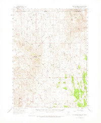
~ Gollaher Mountain NV topo map, 1:62500 scale, 15 X 15 Minute, Historical, 1961, updated 1974
Gollaher Mountain, Nevada, USGS topographic map dated 1961.
Includes geographic coordinates (latitude and longitude). This topographic map is suitable for hiking, camping, and exploring, or framing it as a wall map.
Printed on-demand using high resolution imagery, on heavy weight and acid free paper, or alternatively on a variety of synthetic materials.
Topos available on paper, Waterproof, Poly, or Tyvek. Usually shipping rolled, unless combined with other folded maps in one order.
- Product Number: USGS-5572568
- Free digital map download (high-resolution, GeoPDF): Gollaher Mountain, Nevada (file size: 8 MB)
- Map Size: please refer to the dimensions of the GeoPDF map above
- Weight (paper map): ca. 55 grams
- Map Type: POD USGS Topographic Map
- Map Series: HTMC
- Map Verison: Historical
- Cell ID: 54661
- Scan ID: 320943
- Imprint Year: 1974
- Woodland Tint: Yes
- Aerial Photo Year: 1956
- Field Check Year: 1961
- Datum: NAD27
- Map Projection: Polyconic
- Map published by United States Geological Survey
- Map Language: English
- Scanner Resolution: 600 dpi
- Map Cell Name: Gollaher Mountain
- Grid size: 15 X 15 Minute
- Date on map: 1961
- Map Scale: 1:62500
- Geographical region: Nevada, United States
Neighboring Maps:
All neighboring USGS topo maps are available for sale online at a variety of scales.
Spatial coverage:
Topo map Gollaher Mountain, Nevada, covers the geographical area associated the following places:
- Upper Chimney Spring - Line Spring - Crocket Spring - Moonshine Spring - Indian Mike Spring - Nevada Gulch - Nevada Gulch - Willow Spring - Little Goose Spring - West Basin - Rocky Peak - Devils Pass - Tepee Rock - Boulder Spring - Gollaher Springs Draw - Bedke Well - Fall Creek - Fall Creek - Hot Spring - Mustang Draw - Lower Chimney Spring - State Line Spring - Deadline Ridge - Mustang Spring - Johnson Spring - Indian Mike Creek - Mud Spring - Chokecherry Spring - Eclipse Rock - Manila Spring - Summit Spring - Chicken Spring - Dry Gulch - Gollyer Spring Creek - Gollaher Mountain - Stratton Spring - Big Draw - Toana John Mountains - Tepee Rock - Winter Spring - Elrod Spring - Milligan Creek - Bottom Creek
- Map Area ID: AREA4241.75-114.5-114.25
- Northwest corner Lat/Long code: USGSNW42-114.5
- Northeast corner Lat/Long code: USGSNE42-114.25
- Southwest corner Lat/Long code: USGSSW41.75-114.5
- Southeast corner Lat/Long code: USGSSE41.75-114.25
- Northern map edge Latitude: 42
- Southern map edge Latitude: 41.75
- Western map edge Longitude: -114.5
- Eastern map edge Longitude: -114.25


