
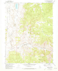
~ Little Fish Lake NV topo map, 1:24000 scale, 7.5 X 7.5 Minute, Historical, 1968, updated 1973
Little Fish Lake, Nevada, USGS topographic map dated 1968.
Includes geographic coordinates (latitude and longitude). This topographic map is suitable for hiking, camping, and exploring, or framing it as a wall map.
Printed on-demand using high resolution imagery, on heavy weight and acid free paper, or alternatively on a variety of synthetic materials.
Topos available on paper, Waterproof, Poly, or Tyvek. Usually shipping rolled, unless combined with other folded maps in one order.
- Product Number: USGS-5569276
- Free digital map download (high-resolution, GeoPDF): Little Fish Lake, Nevada (file size: 12 MB)
- Map Size: please refer to the dimensions of the GeoPDF map above
- Weight (paper map): ca. 55 grams
- Map Type: POD USGS Topographic Map
- Map Series: HTMC
- Map Verison: Historical
- Cell ID: 25964
- Scan ID: 319273
- Imprint Year: 1973
- Woodland Tint: Yes
- Aerial Photo Year: 1967
- Field Check Year: 1968
- Datum: NAD27
- Map Projection: Polyconic
- Map published by United States Geological Survey
- Map Language: English
- Scanner Resolution: 600 dpi
- Map Cell Name: Little Fish Lake
- Grid size: 7.5 X 7.5 Minute
- Date on map: 1968
- Map Scale: 1:24000
- Geographical region: Nevada, United States
Neighboring Maps:
All neighboring USGS topo maps are available for sale online at a variety of scales.
Spatial coverage:
Topo map Little Fish Lake, Nevada, covers the geographical area associated the following places:
- Upper Warm Spring - Fourmile Flats - Squaw Flat - Cress Spring - Mountain View Mill (historical) - Pat Spring - Corral Canyon - Old Dugan Ranch - Little Fish Lake Valley - Page Springs - Indian Jim Mine - Old Page Place - Iron Spring - Page Mine - Little Fish Lake - Arrastra Ruins - Mountain View - Fish Lake Valley Creek - Hot Creek Pass - Cold Spring - Indian Garden Creek - Pot Hole - Box Canyon - Old Dugan Place Hot Spring - Horse Canyon - Dead Cow Ridge - Hot Creek Range
- Map Area ID: AREA38.62538.5-116.5-116.375
- Northwest corner Lat/Long code: USGSNW38.625-116.5
- Northeast corner Lat/Long code: USGSNE38.625-116.375
- Southwest corner Lat/Long code: USGSSW38.5-116.5
- Southeast corner Lat/Long code: USGSSE38.5-116.375
- Northern map edge Latitude: 38.625
- Southern map edge Latitude: 38.5
- Western map edge Longitude: -116.5
- Eastern map edge Longitude: -116.375


