
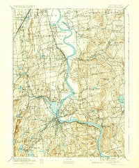
~ Middletown CT topo map, 1:62500 scale, 15 X 15 Minute, Historical, 1893, updated 1936
Middletown, Connecticut, USGS topographic map dated 1893.
Includes geographic coordinates (latitude and longitude). This topographic map is suitable for hiking, camping, and exploring, or framing it as a wall map.
Printed on-demand using high resolution imagery, on heavy weight and acid free paper, or alternatively on a variety of synthetic materials.
Topos available on paper, Waterproof, Poly, or Tyvek. Usually shipping rolled, unless combined with other folded maps in one order.
- Product Number: USGS-5566380
- Free digital map download (high-resolution, GeoPDF): Middletown, Connecticut (file size: 10 MB)
- Map Size: please refer to the dimensions of the GeoPDF map above
- Weight (paper map): ca. 55 grams
- Map Type: POD USGS Topographic Map
- Map Series: HTMC
- Map Verison: Historical
- Cell ID: 57614
- Scan ID: 331074
- Imprint Year: 1936
- Survey Year: 1890
- Datum: Unstated
- Map Projection: Polyconic
- Map published by United States Geological Survey
- Map Language: English
- Scanner Resolution: 600 dpi
- Map Cell Name: Middletown
- Grid size: 15 X 15 Minute
- Date on map: 1893
- Map Scale: 1:62500
- Geographical region: Connecticut, United States
Neighboring Maps:
All neighboring USGS topo maps are available for sale online at a variety of scales.
Spatial coverage:
Topo map Middletown, Connecticut, covers the geographical area associated the following places:
- Cromwell Hills - Welles Village - Baileyville - East Berlin - Maromas - Portland - Fogelmarks Corners - Goodrich Heights - Middlefield - Benvenue (historical) - Buckingham - Oxford Park - Rivermead Mobile Home Park - Naubuc (historical) - Newington Junction - South Wethersfield - Newfield Heights - East Glastonbury - Taylor Town - Elmwood - Long Hill - Bretton Heights - Highland Estates - Berlin - Griswoldville - Highland - Cobalt - Hassunadchuauck (historical) - Wethersfield - Beseck Lake - Colonial Mobile Home Park - Gildersleeve - Goodrich Heights - Westfield - Miramichi - Achenbach - Saybrooke Village - Lakeridge Heights - Cotton Hollow - Hopewell - Middle Haddam - Forest Village - Skinnerville - Elm Hill - Riverdale - Rocky Hill - Cobalt Landing - South Glastonbury - Cromwell - South Farms - Fox Meadows - Glastonbury - Hockanum - Forbes Village - Glastonbury Center - Middletown - North Cromwell - Addison - East Hampton - Newington - Lake Pocotopaug - Long HIll Estates - East Hartford Gardens
- Map Area ID: AREA41.7541.5-72.75-72.5
- Northwest corner Lat/Long code: USGSNW41.75-72.75
- Northeast corner Lat/Long code: USGSNE41.75-72.5
- Southwest corner Lat/Long code: USGSSW41.5-72.75
- Southeast corner Lat/Long code: USGSSE41.5-72.5
- Northern map edge Latitude: 41.75
- Southern map edge Latitude: 41.5
- Western map edge Longitude: -72.75
- Eastern map edge Longitude: -72.5


