
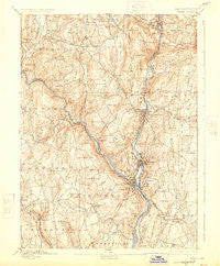
~ Derby CT topo map, 1:62500 scale, 15 X 15 Minute, Historical, 1893, updated 1924
Derby, Connecticut, USGS topographic map dated 1893.
Includes geographic coordinates (latitude and longitude). This topographic map is suitable for hiking, camping, and exploring, or framing it as a wall map.
Printed on-demand using high resolution imagery, on heavy weight and acid free paper, or alternatively on a variety of synthetic materials.
Topos available on paper, Waterproof, Poly, or Tyvek. Usually shipping rolled, unless combined with other folded maps in one order.
- Product Number: USGS-5566292
- Free digital map download (high-resolution, GeoPDF): Derby, Connecticut (file size: 10 MB)
- Map Size: please refer to the dimensions of the GeoPDF map above
- Weight (paper map): ca. 55 grams
- Map Type: POD USGS Topographic Map
- Map Series: HTMC
- Map Verison: Historical
- Cell ID: 53369
- Scan ID: 331021
- Imprint Year: 1924
- Survey Year: 1889
- Datum: NAD
- Map Projection: Polyconic
- Map published by United States Geological Survey
- Map Language: English
- Scanner Resolution: 600 dpi
- Map Cell Name: Derby
- Grid size: 15 X 15 Minute
- Date on map: 1893
- Map Scale: 1:62500
- Geographical region: Connecticut, United States
Neighboring Maps:
All neighboring USGS topo maps are available for sale online at a variety of scales.
Spatial coverage:
Topo map Derby, Connecticut, covers the geographical area associated the following places:
- Monroe - Naugatuck - Bowers Hill - Oronoque Hills North - Cedarhurst - Lakeside - Heritage Village - Kettletown - Kinneytown - Valley Mobile Home Park - Huntington - Orange - Shelton - Stevenson - East Village - Riverside - Paynes Corners - Sunnyside Trailer Park - White Hills - Fairchild Heights Trailer Park - Quaker Farms - Derby - Pine Bridge - East Derby - Cedar Land - Pine Rock Park - Woodbridge - Seymour - Ansonia - Southford - Beacon Falls - Southbury - Robert Hutt Congregate Housing - Straitsville - Riverside - Oxford - Union City - Sunnyside - Long Hill - Millville - West Seymour
- Map Area ID: AREA41.541.25-73.25-73
- Northwest corner Lat/Long code: USGSNW41.5-73.25
- Northeast corner Lat/Long code: USGSNE41.5-73
- Southwest corner Lat/Long code: USGSSW41.25-73.25
- Southeast corner Lat/Long code: USGSSE41.25-73
- Northern map edge Latitude: 41.5
- Southern map edge Latitude: 41.25
- Western map edge Longitude: -73.25
- Eastern map edge Longitude: -73


