
~ Horseshoe Cienega AZ topo map, 1:24000 scale, 7.5 X 7.5 Minute, Historical, 1978, updated 1986
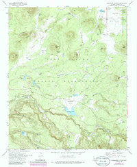
Horseshoe Cienega, Arizona, USGS topographic map dated 1978.
Includes geographic coordinates (latitude and longitude). This topographic map is suitable for hiking, camping, and exploring, or framing it as a wall map.
Printed on-demand using high resolution imagery, on heavy weight and acid free paper, or alternatively on a variety of synthetic materials.
Topos available on paper, Waterproof, Poly, or Tyvek. Usually shipping rolled, unless combined with other folded maps in one order.
- Product Number: USGS-5552814
- Free digital map download (high-resolution, GeoPDF): Horseshoe Cienega, Arizona (file size: 12 MB)
- Map Size: please refer to the dimensions of the GeoPDF map above
- Weight (paper map): ca. 55 grams
- Map Type: POD USGS Topographic Map
- Map Series: HTMC
- Map Verison: Historical
- Cell ID: 21130
- Scan ID: 311800
- Imprint Year: 1986
- Woodland Tint: Yes
- Photo Revision Year: 1985
- Aerial Photo Year: 1984
- Edit Year: 1985
- Field Check Year: 1969
- Datum: NAD27
- Map Projection: Transverse Mercator
- Map published by United States Geological Survey
- Map Language: English
- Scanner Resolution: 600 dpi
- Map Cell Name: Horseshoe Cienega
- Grid size: 7.5 X 7.5 Minute
- Date on map: 1978
- Map Scale: 1:24000
- Geographical region: Arizona, United States
Neighboring Maps:
All neighboring USGS topo maps are available for sale online at a variety of scales.
Spatial coverage:
Topo map Horseshoe Cienega, Arizona, covers the geographical area associated the following places:
- Cinder Tank - Wild Horse Spring - Old Corral Cienega - Cinder Point Mountain - CC Forest Service Facility - Bog Butte - Bog Tank Picnic Ground - Yellow Jacket Cienega - Bar H Creek - Soldier Butte - Bar H Spring - Sand Tank - Brushy Mountain - Section Six Spring - Beaver Dam Park - Sheep Cienega - CC Lake - CC Flat Tank - Gooseberry Butte - CC Francy Spring - CC Fireman Cabin - Ryan Ranch - Paradise Park Youth Camp - CC Spring - Shush Be Tou Dam - Admen Tank - Shush Bezahze Campgrounds - Junction Tank - CC West Spring - Bear Cienega Creek - McCoy Bridge - Shush Be Tou Campgrounds - McNary Ditch - Little Bog Tank Recreation Site - Ditch Campground - CC Hall Spring - CC Tank Number Two - Mattress Cienega - Cinder Point Tank - CC Lake Tank - Bog Tank Dam - Horseshoe Cienega Lake Dam - Shush Be Tou - Penrod Burn - Paradise Creek - Lame Deer Canyon - Paradise Park - CC Tank Number Four - Brown Creek - CC Flat - Little Bog Creek - Shush Bezahze Dam - Cowboy Spring - Brown Butte - Steer Tank - CC Tank Number Three - Horseshoe Cienega Lake Campground - Gooseberry Spring - Cold Spring - Middle Tank - Bog Tank - Moonshine Park - Horseshoe Cienega - Road Tank - Soldier Creek - Elk Spring Cienega - CC Tank Number Five - Line Spring - Lightning Park - Thode Cabin - Horseshoe Cienega Lake - No Name Tank - Brown Butte Tank - CC Tank Number One - Penrod Flat - Shush Bezahze - CC Lake Spring - Elk Spring - Cyclone Lake - Horseshoe Creek - Wild Horse Cienega - Cyclone Lake Campground - Penrod Mountain
- Map Area ID: AREA34.12534-109.75-109.625
- Northwest corner Lat/Long code: USGSNW34.125-109.75
- Northeast corner Lat/Long code: USGSNE34.125-109.625
- Southwest corner Lat/Long code: USGSSW34-109.75
- Southeast corner Lat/Long code: USGSSE34-109.625
- Northern map edge Latitude: 34.125
- Southern map edge Latitude: 34
- Western map edge Longitude: -109.75
- Eastern map edge Longitude: -109.625


