
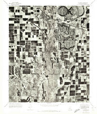
~ El Mirage AZ topo map, 1:24000 scale, 7.5 X 7.5 Minute, Historical, 1971
El Mirage, Arizona, USGS topographic map dated 1971.
Includes geographic coordinates (latitude and longitude). This topographic map is suitable for hiking, camping, and exploring, or framing it as a wall map.
Printed on-demand using high resolution imagery, on heavy weight and acid free paper, or alternatively on a variety of synthetic materials.
Topos available on paper, Waterproof, Poly, or Tyvek. Usually shipping rolled, unless combined with other folded maps in one order.
- Product Number: USGS-5551726
- Free digital map download (high-resolution, GeoPDF): El Mirage, Arizona (file size: 16 MB)
- Map Size: please refer to the dimensions of the GeoPDF map above
- Weight (paper map): ca. 55 grams
- Map Type: POD USGS Topographic Map
- Map Series: HTMC
- Map Verison: Historical
- Cell ID: 13805
- Scan ID: 311249
- Aerial Photo Year: 1971
- Datum: NAD27
- Map Projection: Transverse Mercator
- Orthophoto: Quad
- Map published by United States Geological Survey
- Keywords: Nonstandard Press Run
- Map Language: English
- Scanner Resolution: 600 dpi
- Map Cell Name: El Mirage
- Grid size: 7.5 X 7.5 Minute
- Date on map: 1971
- Map Scale: 1:24000
- Geographical region: Arizona, United States
Neighboring Maps:
All neighboring USGS topo maps are available for sale online at a variety of scales.
Spatial coverage:
Topo map El Mirage, Arizona, covers the geographical area associated the following places:
- Villa Vista - Dysart (historical) - Casa Del Sol Resort West Mobile Home Park - Apollo Mobile Home Park - Hacienda Del Sol Mobile Home Park - Country Greens at Villa de Paz - Westgreen Estates - Chador Mobile Home Park - Rosewood Estates Mobile Home Park - Peoria Polynesian Village - Villa Vista Mobile Home Park - Sun Grove Mobile Home Park - Bumstead - El San Juan Trailer Park - S C Townhouse Mobile Home Estates - Casa del Sol Resorts Number One - Sunset Village - Webb - LaLoma Ranch - White Tanks - Goldbadge - Peoria Polynesian Village Mobile Home Park - El Mirage - Youngtown - Agua Fria - Country Meadows - Sun City
- Map Area ID: AREA33.62533.5-112.375-112.25
- Northwest corner Lat/Long code: USGSNW33.625-112.375
- Northeast corner Lat/Long code: USGSNE33.625-112.25
- Southwest corner Lat/Long code: USGSSW33.5-112.375
- Southeast corner Lat/Long code: USGSSE33.5-112.25
- Northern map edge Latitude: 33.625
- Southern map edge Latitude: 33.5
- Western map edge Longitude: -112.375
- Eastern map edge Longitude: -112.25


