
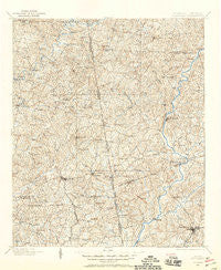
~ Wedowee AL topo map, 1:125000 scale, 30 X 30 Minute, Historical, 1899, updated 1958
Wedowee, Alabama, USGS topographic map dated 1899.
Includes geographic coordinates (latitude and longitude). This topographic map is suitable for hiking, camping, and exploring, or framing it as a wall map.
Printed on-demand using high resolution imagery, on heavy weight and acid free paper, or alternatively on a variety of synthetic materials.
Topos available on paper, Waterproof, Poly, or Tyvek. Usually shipping rolled, unless combined with other folded maps in one order.
- Product Number: USGS-5542837
- Free digital map download (high-resolution, GeoPDF): Wedowee, Alabama (file size: 11 MB)
- Map Size: please refer to the dimensions of the GeoPDF map above
- Weight (paper map): ca. 55 grams
- Map Type: POD USGS Topographic Map
- Map Series: HTMC
- Map Verison: Historical
- Cell ID: 66908
- Scan ID: 305893
- Imprint Year: 1958
- Survey Year: 1899
- Datum: NAD27
- Map Projection: Polyconic
- Map published by United States Geological Survey
- Map Language: English
- Scanner Resolution: 600 dpi
- Map Cell Name: Wedowee
- Grid size: 30 X 30 Minute
- Date on map: 1899
- Map Scale: 1:125000
- Geographical region: Alabama, United States
Neighboring Maps:
All neighboring USGS topo maps are available for sale online at a variety of scales.
Spatial coverage:
Topo map Wedowee, Alabama, covers the geographical area associated the following places:
- Butlers Mill - Beaver Cove - Cambridge - Whitewater Woods - River Trace - Waresville - Standing Rock - The Crossings - Cavers Grove - Waterford Place - Newell - Ridgeway - Heatherbrook - Texas - Curt - Stallings - Burgess - Yellowdirt - Lofty - Veal - Young Acres - Rock Mills - High Shoals - Centralhatchee - Roanoke - Mason - Kaylor - Woodland - Wedowee - Aubrey - Center Chapel - Rivercrest - Harmon Crossroads - Viola - Eagles Rest - Adamson - Creek Ridge - Spring Valley - Finley - Holly Hill - Heritage Hills - Lime - Five Points - Mount Pleasant - Pooles Crossroad - West Wind - Rocky Branch - Taylors Crossroads - Brookstone Estates - Frolona - Stroud - Cameron Cove - Franklin - Fernwood - Springfield - Lake Forest Hills - Riverside - Sassafrass Hills - Bucktown - Yates Crossroads - Oakland - Mahailey Crossroads - Mount Zion - Tennant - Vernon - Capstan (historical) - Cumbee Mill - Vernon Ferry Estates - Gold Ridge - White Signboard Crossroad - Omaha - Rock Fence - Graham - Houston - Red Level - Point North - Napoleon - Moss Creek - Rockwell Estates - Pinehaven Estates - Bacon Level - North Lake - Riverside - Vernon (historical) - Mount Olive - Barkers Crossroads - Shady Oaks - Abbottsford - Shellnut - Ava - Denver - Joel - Crain (historical) - O'Neals Crossroad - Crowder (historical) - La Grange - Rosamond - Teaver Hill - Liberty Grove - Corbin
- Map Area ID: AREA33.533-85.5-85
- Northwest corner Lat/Long code: USGSNW33.5-85.5
- Northeast corner Lat/Long code: USGSNE33.5-85
- Southwest corner Lat/Long code: USGSSW33-85.5
- Southeast corner Lat/Long code: USGSSE33-85
- Northern map edge Latitude: 33.5
- Southern map edge Latitude: 33
- Western map edge Longitude: -85.5
- Eastern map edge Longitude: -85


