
~ Springville AL topo map, 1:125000 scale, 30 X 30 Minute, Historical, 1892, updated 1943
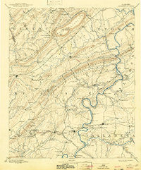
Springville, Alabama, USGS topographic map dated 1892.
Includes geographic coordinates (latitude and longitude). This topographic map is suitable for hiking, camping, and exploring, or framing it as a wall map.
Printed on-demand using high resolution imagery, on heavy weight and acid free paper, or alternatively on a variety of synthetic materials.
Topos available on paper, Waterproof, Poly, or Tyvek. Usually shipping rolled, unless combined with other folded maps in one order.
- Product Number: USGS-5542795
- Free digital map download (high-resolution, GeoPDF): Springville, Alabama (file size: 7 MB)
- Map Size: please refer to the dimensions of the GeoPDF map above
- Weight (paper map): ca. 55 grams
- Map Type: POD USGS Topographic Map
- Map Series: HTMC
- Map Verison: Historical
- Cell ID: 66679
- Scan ID: 305870
- Imprint Year: 1943
- Survey Year: 1887
- Datum: Unstated
- Map Projection: Polyconic
- Map published by United States Geological Survey
- Map Language: English
- Scanner Resolution: 600 dpi
- Map Cell Name: Springville
- Grid size: 30 X 30 Minute
- Date on map: 1892
- Map Scale: 1:125000
- Geographical region: Alabama, United States
Neighboring Maps:
All neighboring USGS topo maps are available for sale online at a variety of scales.
Spatial coverage:
Topo map Springville, Alabama, covers the geographical area associated the following places:
- Shelton Lake Shores - Shady Acres - Lazy V Lake Acres - Dellwood - Turner - Glen City - Plum Springs - Whitney Junction - Coal City - Branchville - Springville - Davis Acres - Steele - Gum Springs (historical) - Walker Subdivision - Lawley - Pell City - Siberton - Riveria Estates - Ragland - Walkerton - Womack (historical) - Smiths Mill - Cane Creek (historical) - Mattawana - Yatesville - Blue Eye (historical) - Stemley Cove - England Isle - Hardwick - Clear Springs - Stewarts - Southside - Tanyard - Park Hill - Chepultepec - Choccolocco Estates - Sanie - Gilbert - Ten Islands - Champion - Margaret - Monte Bello Estates - Pleasant Grove - Dry Valley - Crockertown - Windsong Island - Wolf Creek - Eastwood - Moodys Chapel - Bruner (historical) - Wendy Wood - Odenville - Rainbow City - Lester - Carl Smith Subdivision - Mauldin (historical) - Colony - Logan Martin Lake Estates - Nix (historical) - Acmar - Riverside - Boiling Springs - Eden - Echo Hills - Davis Subdivision - Pine Orchard - Ferguson Crossroad - Minden (historical) - Markton - Wattsville - Forest Hills - Lincoln - Prescott - Ottery - Ilamo - Murphree - Spring Valley Estates - Refuge - Hunting Ridge - Rock Inn Estates - Hoods Crossroads - Appalachian - Oak Ridge - Harmon - Goodwins Mill - Sherwood Shores - Saint Clair Springs - Havilah Hills Estates - Twin Lake Estates - Hill Number 2 - River Terrace Estates - Crestview Gardens - Providence - Binghamtown - Macon - Harrisburg - Avondale Village - Pleasant Grove - Brompton
- Map Area ID: AREA3433.5-86.5-86
- Northwest corner Lat/Long code: USGSNW34-86.5
- Northeast corner Lat/Long code: USGSNE34-86
- Southwest corner Lat/Long code: USGSSW33.5-86.5
- Southeast corner Lat/Long code: USGSSE33.5-86
- Northern map edge Latitude: 34
- Southern map edge Latitude: 33.5
- Western map edge Longitude: -86.5
- Eastern map edge Longitude: -86


