
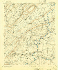
~ Springville AL topo map, 1:125000 scale, 30 X 30 Minute, Historical, 1892, updated 1942
Springville, Alabama, USGS topographic map dated 1892.
Includes geographic coordinates (latitude and longitude). This topographic map is suitable for hiking, camping, and exploring, or framing it as a wall map.
Printed on-demand using high resolution imagery, on heavy weight and acid free paper, or alternatively on a variety of synthetic materials.
Topos available on paper, Waterproof, Poly, or Tyvek. Usually shipping rolled, unless combined with other folded maps in one order.
- Product Number: USGS-5542793
- Free digital map download (high-resolution, GeoPDF): Springville, Alabama (file size: 7 MB)
- Map Size: please refer to the dimensions of the GeoPDF map above
- Weight (paper map): ca. 55 grams
- Map Type: POD USGS Topographic Map
- Map Series: HTMC
- Map Verison: Historical
- Cell ID: 66679
- Scan ID: 305869
- Imprint Year: 1942
- Survey Year: 1887
- Datum: Unstated
- Map Projection: Polyconic
- Map published by United States Geological Survey
- Map Language: English
- Scanner Resolution: 600 dpi
- Map Cell Name: Springville
- Grid size: 30 X 30 Minute
- Date on map: 1892
- Map Scale: 1:125000
- Geographical region: Alabama, United States
Neighboring Maps:
All neighboring USGS topo maps are available for sale online at a variety of scales.
Spatial coverage:
Topo map Springville, Alabama, covers the geographical area associated the following places:
- Cape Choccolocco - Blue Eye - Boiling Springs - Ferguson Crossroad - Mitchellville - Riveria Estates - Oak Ridge - Ramsey - Ragland - Cochran Springs (historical) - Carl Smith Subdivision - Lester - Clubview Heights - Williams - Straight Mountain - Highland Lake - Harmon - Otipalin (historical) - Spring Valley Estates - Lawley - Enchanted Hills - Appalachian - Branchville - The Brick Store - Pleasant Grove - Gilbert - Eureka Shores - Boozer (historical) - Acmar - Odenville - Twin Lake Estates - Walkerton - Ottery - Morgans Crossroads - Old Eastaboga - Chandler Mountain - Logan Martin Lake Estates - Saint Clair Springs - Pine Orchard - Stemley - Forest Hills - Pleasant Grove - Valleyhaven - Avondale Village - Camelot Plateau - Woody Acres - Eden - Pell City - Bethlehem - Francis - Sherwood Shores - Yatesville - Ten Islands - Dellwood - Murphree - Martins Mill - Echo Hills - Pleasant Valley - Sanie - Steele - Griffitts Lake Shore Subdivision - Coal City - Shady Acres - Lakeview - Hardwick - Ashville - Hood - Fairview - Stewarts Crossroads - Windsong Island - Whitney - Blue Eye (historical) - Dry Valley - Nash (historical) - Bruner (historical) - Clear Springs (historical) - Rainbow City - Hunting Ridge - Cool Springs - Capri Islands - England Isle - Crockertown - Minden (historical) - Brannon Springs (historical) - Glen City - Cooks Springs - Cane Creek (historical) - Gum Springs (historical) - Stemley Cove - River Terrace Estates - Hill Number 1 - Sulphur Springs - Refuge - Catatoga Estates - Shahan (historical) - Park Hill - Colony - Havilah Hills Estates - Wolf Creek - Dunrowin
- Map Area ID: AREA3433.5-86.5-86
- Northwest corner Lat/Long code: USGSNW34-86.5
- Northeast corner Lat/Long code: USGSNE34-86
- Southwest corner Lat/Long code: USGSSW33.5-86.5
- Southeast corner Lat/Long code: USGSSE33.5-86
- Northern map edge Latitude: 34
- Southern map edge Latitude: 33.5
- Western map edge Longitude: -86.5
- Eastern map edge Longitude: -86


