
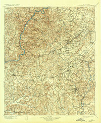
~ Brookwood AL topo map, 1:125000 scale, 30 X 30 Minute, Historical, 1899, updated 1932
Brookwood, Alabama, USGS topographic map dated 1899.
Includes geographic coordinates (latitude and longitude). This topographic map is suitable for hiking, camping, and exploring, or framing it as a wall map.
Printed on-demand using high resolution imagery, on heavy weight and acid free paper, or alternatively on a variety of synthetic materials.
Topos available on paper, Waterproof, Poly, or Tyvek. Usually shipping rolled, unless combined with other folded maps in one order.
- Product Number: USGS-5542697
- Free digital map download (high-resolution, GeoPDF): Brookwood, Alabama (file size: 11 MB)
- Map Size: please refer to the dimensions of the GeoPDF map above
- Weight (paper map): ca. 55 grams
- Map Type: POD USGS Topographic Map
- Map Series: HTMC
- Map Verison: Historical
- Cell ID: 65065
- Scan ID: 305816
- Imprint Year: 1932
- Survey Year: 1895
- Datum: Unstated
- Map Projection: Polyconic
- Map published by United States Geological Survey
- Map Language: English
- Scanner Resolution: 600 dpi
- Map Cell Name: Brookwood
- Grid size: 30 X 30 Minute
- Date on map: 1899
- Map Scale: 1:125000
- Geographical region: Alabama, United States
Neighboring Maps:
All neighboring USGS topo maps are available for sale online at a variety of scales.
Spatial coverage:
Topo map Brookwood, Alabama, covers the geographical area associated the following places:
- Hargrove (historical) - Deep Wood - Blue Creek - Marvel - Old Mill Trace - Tannehill - Ezra - Docray - Scottsville - Brentwood - Masena - Lucille - Grimes - Chambers - Bull City - Lowetown - Bibbville - Lakeridge - Ardela (historical) - Flat Top - Academy Park - Raintree Country - Cedar Cove - Eastern Hills - Canyon Lakes - Woodland Pines - Woodland Hills - Pattersontown - West Blocton - Woodmont - Cherrywood - Oak Grove - Nichol Hills - Hillsdale - Arrow Wood - Little Hope - Pearson - Valley Creek - Providence - Holt - Oak Grove - Lake View - Braehead (historical) - Three Branches Estates - Gray Hill - Primitive Ridge - South Holt Highlands - Rock Creek - Monticello Estates - Beech Hills - Virginia - El Dorado East - The Staffords - Walker Subdivision - Cane Creek (historical) - Pilgrim Rest (historical) - Garnsey - Duncanville - Clyde Jones Subdivision - Windsor Drive - Elm Ridge - Confederate Hill Estates - Seymour - Box Springs - Austin Subdivision - Fikestown (historical) - Lynn Haven - Blocton (historical) - Toadvine - Woodstock - Giles - Eastover - Bucktown (historical) - Altamont - Tannehill Valley Estates - Druid Hills - Woodland Terrace - Laurel Hills - Chinn - Cottonwood Park - Standridge - McAdory - Bucksville - Golden Acres - Woodland Forest - Hazelhurst - Italian Town - Concord - Springhill Lake - Shawtown - Hillswood - Stewart Settlement - Arcadia - East Park - Howton - Caffee Junction - Dudley - Cottondale - New Hargrove (historical) - Red Hill Heights
- Map Area ID: AREA33.533-87.5-87
- Northwest corner Lat/Long code: USGSNW33.5-87.5
- Northeast corner Lat/Long code: USGSNE33.5-87
- Southwest corner Lat/Long code: USGSSW33-87.5
- Southeast corner Lat/Long code: USGSSE33-87
- Northern map edge Latitude: 33.5
- Southern map edge Latitude: 33
- Western map edge Longitude: -87.5
- Eastern map edge Longitude: -87


