
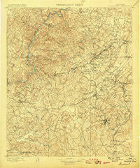
~ Brookwood AL topo map, 1:125000 scale, 30 X 30 Minute, Historical, 1899
Brookwood, Alabama, USGS topographic map dated 1899.
Includes geographic coordinates (latitude and longitude). This topographic map is suitable for hiking, camping, and exploring, or framing it as a wall map.
Printed on-demand using high resolution imagery, on heavy weight and acid free paper, or alternatively on a variety of synthetic materials.
Topos available on paper, Waterproof, Poly, or Tyvek. Usually shipping rolled, unless combined with other folded maps in one order.
- Product Number: USGS-5542691
- Free digital map download (high-resolution, GeoPDF): Brookwood, Alabama (file size: 10 MB)
- Map Size: please refer to the dimensions of the GeoPDF map above
- Weight (paper map): ca. 55 grams
- Map Type: POD USGS Topographic Map
- Map Series: HTMC
- Map Verison: Historical
- Cell ID: 65065
- Scan ID: 305813
- Survey Year: 1895
- Datum: Unstated
- Map Projection: Unstated
- Map published by United States Geological Survey
- Map Language: English
- Scanner Resolution: 600 dpi
- Map Cell Name: Brookwood
- Grid size: 30 X 30 Minute
- Date on map: 1899
- Map Scale: 1:125000
- Geographical region: Alabama, United States
Neighboring Maps:
All neighboring USGS topo maps are available for sale online at a variety of scales.
Spatial coverage:
Topo map Brookwood, Alabama, covers the geographical area associated the following places:
- Blocton (historical) - McCalla - Cumberland Park - Smith Hill - Shawtown - Nash Town (historical) - Johns - Cottonwood Park - Yolande - Arrow Wood - East Park - Tannehill Valley Estates - Lucille - Hargrove (historical) - Flint Hill - Flat Top - Dowdle - Providence - Concord - Pattersontown - Walker Subdivision - Hillswood - Fikestown (historical) - Oxford Gate - El Dorado East - Austin Subdivision - Rock Creek - Hawkinsville (historical) - Holt - Clearview Hills - Woodland Park - Moffat - Hazelhurst - Primitive Ridge - Glenwood Park - Coaling - Pilgrim Rest (historical) - Westview - Harmon - Eastern Hills - Caffee Junction - Hillview - Box Springs - Bucksville - Lawsontown - McGrawtown - Banks Villa East - Berkley Hills - Red Hill Heights - Green Pond - Bullard Shoals (historical) - High Point - Nichol Hills - Academy Park - Chambers - Woodstock - North Bibb - Norris Estates - Ardela (historical) - Windham Springs - Chinn - Hebron - Canyon Lakes - Woodland Terrace - Grimes - Woodland Hills - Arcadia - Raintree Country - Vines Mill - Judson Park - Red Eagle - Hopkins - Fleetwood - Clyde Jones Subdivision - Tannehill - Summerfield - Cloester Valley - Blockton Junc - Briarwood - North Johns - Lake View - East Lake - Virginia - Belle Ellen - Broadview - Giles - Elm Ridge - Kimbrell - Rickey - Johnstown - Belchers - Corinne (historical) - Black Diamond - Cresent Heights - Three Branches Estates - Peach Grove - River Bend (historical) - Lakeview Estates - Oak Grove - Mayfair
- Map Area ID: AREA33.533-87.5-87
- Northwest corner Lat/Long code: USGSNW33.5-87.5
- Northeast corner Lat/Long code: USGSNE33.5-87
- Southwest corner Lat/Long code: USGSSW33-87.5
- Southeast corner Lat/Long code: USGSSE33-87
- Northern map edge Latitude: 33.5
- Southern map edge Latitude: 33
- Western map edge Longitude: -87.5
- Eastern map edge Longitude: -87


