
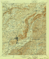
~ Anniston AL topo map, 1:125000 scale, 30 X 30 Minute, Historical, 1900, updated 1941
Anniston, Alabama, USGS topographic map dated 1900.
Includes geographic coordinates (latitude and longitude). This topographic map is suitable for hiking, camping, and exploring, or framing it as a wall map.
Printed on-demand using high resolution imagery, on heavy weight and acid free paper, or alternatively on a variety of synthetic materials.
Topos available on paper, Waterproof, Poly, or Tyvek. Usually shipping rolled, unless combined with other folded maps in one order.
- Product Number: USGS-5542653
- Free digital map download (high-resolution, GeoPDF): Anniston, Alabama (file size: 11 MB)
- Map Size: please refer to the dimensions of the GeoPDF map above
- Weight (paper map): ca. 55 grams
- Map Type: POD USGS Topographic Map
- Map Series: HTMC
- Map Verison: Historical
- Cell ID: 64889
- Scan ID: 305788
- Imprint Year: 1941
- Survey Year: 1898
- Datum: Unstated
- Map Projection: Polyconic
- Map published by United States Geological Survey
- Map Language: English
- Scanner Resolution: 600 dpi
- Map Cell Name: Anniston
- Grid size: 30 X 30 Minute
- Date on map: 1900
- Map Scale: 1:125000
- Geographical region: Alabama, United States
Neighboring Maps:
All neighboring USGS topo maps are available for sale online at a variety of scales.
Spatial coverage:
Topo map Anniston, Alabama, covers the geographical area associated the following places:
- Prickettville - Hollingsworth - Glencoe - Bonny Brook - Coldwater - Possum Trot - Harmony - Jacksonville - Leatherwood - Oak Hill - Goshen (historical) - New Haven - Reaves - Betta-Life - Pleasant Valley (historical) - Pleasant Ridge - Hill Top (historical) - Anniston - Five Points - Blue Springs (historical) - Lenlock - Holley Crossroads - Tarsus - Irene (historical) - Burns Park - Chigger Ridge (historical) - Polkville (historical) - Oak Level - Merrellton - Peaceburg - Melrose - Grant Town - Dailey (historical) - Allsop - Nances Creek - Reads Mill - Holly Springs - Hobson City - Tarsus (historical) - Webster Chapel - Mechanicsville - Sweet Home - Zuni (historical) - Piedmont Springs - McFrey Crossroads - Cedar Springs - Post Oak - Brutonville - Tooktocaugee (historical) - Four Mile - Hicks - West Wellington - Parkwood - Blue Mountain - Gold Hill - McAding - De Soto Manor - Ladiga - Middleton - Laney - McKibben - Rock Spring - Knightens Crossroads - Spring Valley - Gauldinville - Hebron (historical) - Woodland Park - Masingale (historical) - Lardent - Nisbit (historical) - Munford - Jenifer - Duke - Mount Gilead (historical) - Laney - Couch - Ewing - Greenwood - Weaver - Oxford - Richeytown - Hillcrest - Grantley - Vigo - Halls Chapel - Old Goshen Center (historical) - Beasley (historical) - Kentuck - Burns Crossroad - West End Anniston - Pleasant Gap - Trinity - Meadowbrook - Sulphur Springs - Philadelphia - Cleburne - Boiling Spring - Chulafinnee - Keysburg - Piedmont
- Map Area ID: AREA3433.5-86-85.5
- Northwest corner Lat/Long code: USGSNW34-86
- Northeast corner Lat/Long code: USGSNE34-85.5
- Southwest corner Lat/Long code: USGSSW33.5-86
- Southeast corner Lat/Long code: USGSSE33.5-85.5
- Northern map edge Latitude: 34
- Southern map edge Latitude: 33.5
- Western map edge Longitude: -86
- Eastern map edge Longitude: -85.5


