
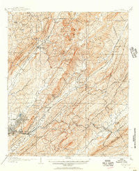
~ Leeds AL topo map, 1:62500 scale, 15 X 15 Minute, Historical, 1905, updated 1956
Leeds, Alabama, USGS topographic map dated 1905.
Includes geographic coordinates (latitude and longitude). This topographic map is suitable for hiking, camping, and exploring, or framing it as a wall map.
Printed on-demand using high resolution imagery, on heavy weight and acid free paper, or alternatively on a variety of synthetic materials.
Topos available on paper, Waterproof, Poly, or Tyvek. Usually shipping rolled, unless combined with other folded maps in one order.
- Product Number: USGS-5542365
- Free digital map download (high-resolution, GeoPDF): Leeds, Alabama (file size: 12 MB)
- Map Size: please refer to the dimensions of the GeoPDF map above
- Weight (paper map): ca. 55 grams
- Map Type: POD USGS Topographic Map
- Map Series: HTMC
- Map Verison: Historical
- Cell ID: 56634
- Scan ID: 305616
- Imprint Year: 1956
- Survey Year: 1905
- Datum: NAD27
- Map Projection: Polyconic
- Map published by United States Geological Survey
- Map Language: English
- Scanner Resolution: 600 dpi
- Map Cell Name: Leeds
- Grid size: 15 X 15 Minute
- Date on map: 1905
- Map Scale: 1:62500
- Geographical region: Alabama, United States
Neighboring Maps:
All neighboring USGS topo maps are available for sale online at a variety of scales.
Spatial coverage:
Topo map Leeds, Alabama, covers the geographical area associated the following places:
- East Irondale - Von Dale - East Trussville (historical) - Hunters Hill - Sun Valley - Oak Crossing - Nelson Heights - Overbrook Estates - Pawnee Heights - Norris Junction - Jefferson Park - Huffman Gardens - East Lake - Grants Mill - Roebuck - Brentwood Hills - Winburn - Rock Ridge - Spring Lake Estates - Misty Pines - Fernwood Estates - Echo Hills - Crestline Gardens - Brookhurst - Oakville - Pine Knoll Vista - Valley Crest Estates - Godwin Estates - Roebuck Terrace - Roebuck Springs - Russell Heights - Larkwood - Parsons - Brookmont - North Lake Park - Roebuck Plaza - Gable Cove - Euclid Estates - Springdale - Biscayne Highlands - Overton - Eastwood Mobile Home Plaza - Cahaba Village - Trotwood Park - Rolling Hills - Robinwood - Southern Acres - East Haven - Vanns - Cotton Ridge - Killough Springs - Crestview Hills - Braggsville - Ruffner - Roebuck Gardens - Center Point - Weems - Penfield Heights - Roebuck Crest Estates - Hampton Place - Stoneridge - Lovick - Bridlewood Forest Estates - Cherokee Brook Estates - Northgate Trailer Park - Cahaba Crest - Barnisdale Forest - Dogwood Estates - Lake Highlands - Magnolia Courts - Oak Ridge Park - Woodaire Estates - Markeeta - Monmouth - Leeds - Cedar Grove (historical) - Wahouma - Autumn Chase - Countryside Estates - Kingsway Terrace - Gate City - Queenstown - Shady Acres Trailer Park - Plaza Mobile Home Park - Fitzgerald Estates - Argo - Lynn Acres - Nottingham - Zion City - Central Highlands - Ayres - Breakstone Village - Innsbrooke - Arrowhead - Woodward - Woodland Village - Forest Acres - Trussville Manor - Woodlawn Heights - Center Point Gardens
- Map Area ID: AREA33.7533.5-86.75-86.5
- Northwest corner Lat/Long code: USGSNW33.75-86.75
- Northeast corner Lat/Long code: USGSNE33.75-86.5
- Southwest corner Lat/Long code: USGSSW33.5-86.75
- Southeast corner Lat/Long code: USGSSE33.5-86.5
- Northern map edge Latitude: 33.75
- Southern map edge Latitude: 33.5
- Western map edge Longitude: -86.75
- Eastern map edge Longitude: -86.5


