
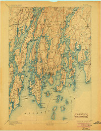
~ Boothbay ME topo map, 1:62500 scale, 15 X 15 Minute, Historical, 1893, updated 1905
Boothbay, Maine, USGS topographic map dated 1893.
Includes geographic coordinates (latitude and longitude). This topographic map is suitable for hiking, camping, and exploring, or framing it as a wall map.
Printed on-demand using high resolution imagery, on heavy weight and acid free paper, or alternatively on a variety of synthetic materials.
Topos available on paper, Waterproof, Poly, or Tyvek. Usually shipping rolled, unless combined with other folded maps in one order.
- Product Number: USGS-5536179
- Free digital map download (high-resolution, GeoPDF): Boothbay, Maine (file size: 7 MB)
- Map Size: please refer to the dimensions of the GeoPDF map above
- Weight (paper map): ca. 55 grams
- Map Type: POD USGS Topographic Map
- Map Series: HTMC
- Map Verison: Historical
- Cell ID: 51646
- Scan ID: 807401
- Imprint Year: 1905
- Survey Year: 1891
- Datum: Unstated
- Map Projection: Unstated
- Map published by United States Geological Survey
- Map Language: English
- Scanner Resolution: 508 dpi
- Map Cell Name: Boothbay
- Grid size: 15 X 15 Minute
- Date on map: 1893
- Map Scale: 1:62500
- Geographical region: Maine, United States
Neighboring Maps:
All neighboring USGS topo maps are available for sale online at a variety of scales.
Spatial coverage:
Topo map Boothbay, Maine, covers the geographical area associated the following places:
- Edgecomb - Bristol - Robinhood - Linekin - Mouse Island - Pools Landing - Ocean Point - Pemaquid Harbor - Walpole - Pemaquid Point - Bayville - Spruceworld - Hendricks Harbor - Georgetown - Mount Pisgah - Trevett - Back Narrows - Boothbay - Pine Cliff - Murphys Corner - Christmas Cove - West Boothbay Harbor - Pemaquid Beach - Heron Island - Pemaquid - West Bristol - Westport - Fort Edgecomb - East Edgecomb - Pemaquid (historical) - Five Islands - MacMahan - East Boothbay - Spruce Shores - Oak Hill - South Bristol - Southport - Montsweag - Dover - North Edgecomb - Newagen - West Southport - Boothbay Harbor
- Map Area ID: AREA4443.75-69.75-69.5
- Northwest corner Lat/Long code: USGSNW44-69.75
- Northeast corner Lat/Long code: USGSNE44-69.5
- Southwest corner Lat/Long code: USGSSW43.75-69.75
- Southeast corner Lat/Long code: USGSSE43.75-69.5
- Northern map edge Latitude: 44
- Southern map edge Latitude: 43.75
- Western map edge Longitude: -69.75
- Eastern map edge Longitude: -69.5


