
~ Quincy IL topo map, 1:250000 scale, 1 X 2 Degree, Historical, 1948, updated 1948
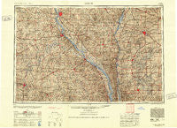
Quincy, Illinois, USGS topographic map dated 1948.
Includes geographic coordinates (latitude and longitude). This topographic map is suitable for hiking, camping, and exploring, or framing it as a wall map.
Printed on-demand using high resolution imagery, on heavy weight and acid free paper, or alternatively on a variety of synthetic materials.
Topos available on paper, Waterproof, Poly, or Tyvek. Usually shipping rolled, unless combined with other folded maps in one order.
- Product Number: USGS-5532949
- Free digital map download (high-resolution, GeoPDF): Quincy, Illinois (file size: 21 MB)
- Map Size: please refer to the dimensions of the GeoPDF map above
- Weight (paper map): ca. 55 grams
- Map Type: POD USGS Topographic Map
- Map Series: HTMC
- Map Verison: Historical
- Cell ID: 68979
- Scan ID: 310174
- Imprint Year: 1948
- Aerial Photo Year: 1944
- Datum: NAD27
- Map Projection: Transverse Mercator
- Map published by United States Army Corps of Engineers
- Map published by United States Army
- Map Language: English
- Scanner Resolution: 600 dpi
- Map Cell Name: Quincy
- Grid size: 1 X 2 Degree
- Date on map: 1948
- Map Scale: 1:250000
- Geographical region: Illinois, United States
Neighboring Maps:
All neighboring USGS topo maps are available for sale online at a variety of scales.
Spatial coverage:
Topo map Quincy, Illinois, covers the geographical area associated the following places:
- Maywood - Perry - Cave City - Reader - Brussells - Cherry Lane Estates - Okete - Kaser - Belltown - Hope - Mundy Landing - Naomi - South Jacksonville - Hickory Grove - Uva - Saint Clement - Rockport - Mark - Titus - Slees Mills - Markham - La Grange - Cass (historical) - Kisch - Glasgow - Hagener - Griggsville - Monroe City - Strawns Crossing - Center - Shamrock - Burksville - Spencer - Lamb - Stoutsville - Starkdale (historical) - Miles Station - Belleview - Ilasco - Brownton (historical) - Sinclair - Frankford - Seehorn - Franklin - Exeter - Farber - Turner Landing - Nebo - Warren - Palmyra - Chesterfield - Argola - Aladdin - Literberry - Hersman - Shaver Ford - Barry - Dutton (historical) - Joanna - Hanks Station - Shipman - Sigsbee - Hadley - Payson - Dodge City - Shepherd - Mashek (historical) - Kane - Woodland - New Philadelphia - Jules - Rush Hill - Buzzards Roost - Joy Prairie - Pittsfield - Davis - Reardon - Scottville - LaMotte - Philadelphia - New Hartford - Perry - Berdan - Philadelphia - Holiday Hills - Country Meadows - Truxton - Vera - Fidelity - Kemper - Naples - Oasis - Clarksville - Elgin - Glendale - Bluffs - Quincy Junction - Monkey Run - Wrights - Columbus (historical)
- Map Area ID: AREA4039-92-90
- Northwest corner Lat/Long code: USGSNW40-92
- Northeast corner Lat/Long code: USGSNE40-90
- Southwest corner Lat/Long code: USGSSW39-92
- Southeast corner Lat/Long code: USGSSE39-90
- Northern map edge Latitude: 40
- Southern map edge Latitude: 39
- Western map edge Longitude: -92
- Eastern map edge Longitude: -90


