
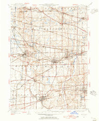
~ Wheaton IL topo map, 1:62500 scale, 15 X 15 Minute, Historical, 1948, updated 1956
Wheaton, Illinois, USGS topographic map dated 1948.
Includes geographic coordinates (latitude and longitude). This topographic map is suitable for hiking, camping, and exploring, or framing it as a wall map.
Printed on-demand using high resolution imagery, on heavy weight and acid free paper, or alternatively on a variety of synthetic materials.
Topos available on paper, Waterproof, Poly, or Tyvek. Usually shipping rolled, unless combined with other folded maps in one order.
- Product Number: USGS-5532753
- Free digital map download (high-resolution, GeoPDF): Wheaton, Illinois (file size: 9 MB)
- Map Size: please refer to the dimensions of the GeoPDF map above
- Weight (paper map): ca. 55 grams
- Map Type: POD USGS Topographic Map
- Map Series: HTMC
- Map Verison: Historical
- Cell ID: 64454
- Scan ID: 310070
- Imprint Year: 1956
- Survey Year: 1906
- Datum: NAD27
- Map Projection: Polyconic
- Map published by United States Geological Survey
- Map Language: English
- Scanner Resolution: 600 dpi
- Map Cell Name: Wheaton
- Grid size: 15 X 15 Minute
- Date on map: 1948
- Map Scale: 1:62500
- Geographical region: Illinois, United States
Neighboring Maps:
All neighboring USGS topo maps are available for sale online at a variety of scales.
Spatial coverage:
Topo map Wheaton, Illinois, covers the geographical area associated the following places:
- Geneva Road - Belmont - Warrenhurst - Warrenville - Gretna - Flowerfield - Wheaton - Wayne - Carol Stream - Naperville - Schick - Downers Grove - Hanover Park - Valley View - Jewell Road - Prince Crossing - Spring Lake Mobile Home Park - Arboretum Estates - Highland Hills - Batavia Junction - Saddlewood - Roselle - Munger - Foxcroft - Swift - Cloverdale - Itasca - Lombard - Bartlett - North Glen Ellyn - Glendale Heights - Shorewood - Glen Ellyn - Keeneyville - Glen Oak - Eola - Lakewood - Lisle - Bloomingdale - Medinah - Winfield - Wayne Center - Ontarioville - Ingalton - West Chicago
- Map Area ID: AREA4241.75-88.25-88
- Northwest corner Lat/Long code: USGSNW42-88.25
- Northeast corner Lat/Long code: USGSNE42-88
- Southwest corner Lat/Long code: USGSSW41.75-88.25
- Southeast corner Lat/Long code: USGSSE41.75-88
- Northern map edge Latitude: 42
- Southern map edge Latitude: 41.75
- Western map edge Longitude: -88.25
- Eastern map edge Longitude: -88


