
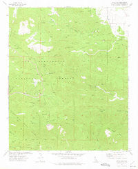
~ Onyx Peak CA topo map, 1:24000 scale, 7.5 X 7.5 Minute, Historical, 1972, updated 1975
Onyx Peak, California, USGS topographic map dated 1972.
Includes geographic coordinates (latitude and longitude). This topographic map is suitable for hiking, camping, and exploring, or framing it as a wall map.
Printed on-demand using high resolution imagery, on heavy weight and acid free paper, or alternatively on a variety of synthetic materials.
Topos available on paper, Waterproof, Poly, or Tyvek. Usually shipping rolled, unless combined with other folded maps in one order.
- Product Number: USGS-5519969
- Free digital map download (high-resolution, GeoPDF): Onyx Peak, California (file size: 11 MB)
- Map Size: please refer to the dimensions of the GeoPDF map above
- Weight (paper map): ca. 55 grams
- Map Type: POD USGS Topographic Map
- Map Series: HTMC
- Map Verison: Historical
- Cell ID: 33287
- Scan ID: 293734
- Imprint Year: 1975
- Woodland Tint: Yes
- Aerial Photo Year: 1970
- Field Check Year: 1972
- Datum: NAD27
- Map Projection: Lambert Conformal Conic
- Map published by United States Geological Survey
- Map Language: English
- Scanner Resolution: 600 dpi
- Map Cell Name: Onyx Peak
- Grid size: 7.5 X 7.5 Minute
- Date on map: 1972
- Map Scale: 1:24000
- Geographical region: California, United States
Neighboring Maps:
All neighboring USGS topo maps are available for sale online at a variety of scales.
Spatial coverage:
Topo map Onyx Peak, California, covers the geographical area associated the following places:
- Tayles Hidden Acres - Yocum Spring - Old Timer Canyon - Onyx Summit - Deer Spring - Broom Spring - Bain Ranch - Three Sisters Peaks - Heartbreak Ridge - Pipes Campground - Blue Cut - Round Valley - Onyx Mine - Cienaga Seca - Onyx Spring - Mineral Mountain - Coon Creek Jumpoff - Monte Cristo Mine - Missed Spring - Broom Flat - Rose Mine - Little Cienaga Seca - Pipes Spring
- Map Area ID: AREA34.2534.125-116.75-116.625
- Northwest corner Lat/Long code: USGSNW34.25-116.75
- Northeast corner Lat/Long code: USGSNE34.25-116.625
- Southwest corner Lat/Long code: USGSSW34.125-116.75
- Southeast corner Lat/Long code: USGSSE34.125-116.625
- Northern map edge Latitude: 34.25
- Southern map edge Latitude: 34.125
- Western map edge Longitude: -116.75
- Eastern map edge Longitude: -116.625


