
~ San Jose CA topo map, 1:250000 scale, 1 X 2 Degree, Historical, 1956, updated 1956
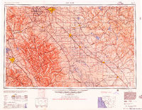
San Jose, California, USGS topographic map dated 1956.
Includes geographic coordinates (latitude and longitude). This topographic map is suitable for hiking, camping, and exploring, or framing it as a wall map.
Printed on-demand using high resolution imagery, on heavy weight and acid free paper, or alternatively on a variety of synthetic materials.
Topos available on paper, Waterproof, Poly, or Tyvek. Usually shipping rolled, unless combined with other folded maps in one order.
- Product Number: USGS-5506679
- Free digital map download (high-resolution, GeoPDF): San Jose, California (file size: 18 MB)
- Map Size: please refer to the dimensions of the GeoPDF map above
- Weight (paper map): ca. 55 grams
- Map Type: POD USGS Topographic Map
- Map Series: HTMC
- Map Verison: Historical
- Cell ID: 74989
- Scan ID: 302122
- Imprint Year: 1956
- Aerial Photo Year: 1945
- Datum: NAD27
- Map Projection: Transverse Mercator
- Map published by United States Army Corps of Engineers
- Map published by United States Army
- Map Language: English
- Scanner Resolution: 600 dpi
- Map Cell Name: San Jose
- Grid size: 1 X 2 Degree
- Date on map: 1956
- Map Scale: 1:250000
- Geographical region: California, United States
Neighboring Maps:
All neighboring USGS topo maps are available for sale online at a variety of scales.
Spatial coverage:
Topo map San Jose, California, covers the geographical area associated the following places:
- Kadota - Five Corners - Seven Trees - Dos Palos Y - Irwin - Berryessa - Kennedy - Sierra Vista - Shinn - Ellis (historical) - Lexington Hills - Soulsbyville - Bethany Park - Priest - Lick - Stevinson - Burbank - Hilmar - Plains (historical) - Shannon - Indian Gulch - Bixler - El Nido - Plainsburg - Scenic Brook - Farwell - Linora (historical) - East Pleasanton - Casa Amigo Mobile Home Park - Newman - Hickman - Granite Springs - Ash (historical) - Cowell - Delhi - Altamont - Heinlenville (historical) - Stomar - Newlove - Asco - Amsterdam - Escalon - El Pinal - Mormon - Copperopolis - Dublin - Ralph - Peters - Tillman (historical) - Merced - La Branza (historical) - Diablo Grande - Turlock - Country Club - Lathrop - Magnetic Spring (historical) - Lambert Lake Estates - San Ramon - Dogtown - Park Sierra Mobile Home Park - Solyo - Sand Hill - Campbell - Greeley Hill - Chinatown (historical) - Avena - Farmington - Lawrence - Warnerville - Santa Nella Village - Atlanta - Shackelford - Rancho Poquitos - Hetch Hetchy Junction - Esmar (historical) - The Homestead - Larson - Perry - Buhach - West Hartley - Ingomar - Castle Gardens - Midway - Mendenhall Springs - Keystone - Sonora Ranchettes - Holy City - Vernalis - Sunol - Alviso - Austin - Verona - Twin Creeks - Del Rio - Ulmar - Cambrian Park - Big Oak Flat - Copper Cove Subdivision - Standiford - Ceres
- Map Area ID: AREA3837-122-120
- Northwest corner Lat/Long code: USGSNW38-122
- Northeast corner Lat/Long code: USGSNE38-120
- Southwest corner Lat/Long code: USGSSW37-122
- Southeast corner Lat/Long code: USGSSE37-120
- Northern map edge Latitude: 38
- Southern map edge Latitude: 37
- Western map edge Longitude: -122
- Eastern map edge Longitude: -120


