
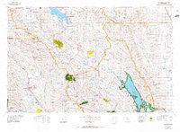
~ Healdsburg CA topo map, 1:100000 scale, 30 X 60 Minute, Historical, 1972, updated 1975
Healdsburg, California, USGS topographic map dated 1972.
Includes geographic coordinates (latitude and longitude). This topographic map is suitable for hiking, camping, and exploring, or framing it as a wall map.
Printed on-demand using high resolution imagery, on heavy weight and acid free paper, or alternatively on a variety of synthetic materials.
Topos available on paper, Waterproof, Poly, or Tyvek. Usually shipping rolled, unless combined with other folded maps in one order.
- Product Number: USGS-5505293
- Free digital map download (high-resolution, GeoPDF): Healdsburg, California (file size: 27 MB)
- Map Size: please refer to the dimensions of the GeoPDF map above
- Weight (paper map): ca. 55 grams
- Map Type: POD USGS Topographic Map
- Map Series: HTMC
- Map Verison: Historical
- Cell ID: 67656
- Scan ID: 299092
- Imprint Year: 1975
- Woodland Tint: Yes
- Aerial Photo Year: 1972
- Datum: NAD27
- Map Projection: Universal Transverse Mercator
- Map published by United States Geological Survey
- Map Language: English
- Scanner Resolution: 600 dpi
- Map Cell Name: Healdsburg
- Grid size: 30 X 60 Minute
- Date on map: 1972
- Map Scale: 1:100000
- Geographical region: California, United States
Neighboring Maps:
All neighboring USGS topo maps are available for sale online at a variety of scales.
Spatial coverage:
Topo map Healdsburg, California, covers the geographical area associated the following places:
- Wikiup - Vineyard Valley Mobile Home Park - Harrington - Riviera Estates - Knoxville - El Bonita - Lower Lake - Angwin - Rio Nido - Tancred - Veteran Heights - Highland Springs - Berryessa Highlands - Steel Canyon Resort - Wilson Grove - Mount Jackson - Del Rio Woods - Chiquita - Guerneville - Bonanza Springs - Clear Lake Riviera - Walter Springs - Ettawa Springs - Clearlake - Jimtown - Monticello (historical) - Caldwell Pines - Simi - Brooks - Odd Fellows Park - Calistoga - Korbel - Saint Helena - Mercuryville - Nervo - Pope Valley - Hollydale - Cobb - Capay - Shiloh - Barro - Healdsburg - Aetna Springs - Russian River Terrace - Harbin Springs - Clearlake Park - Mount Hannah Lodge - Redbud Park (historical) - Spanish Flat - Clearlake Highlands - Howard Springs - Kellogg - Rolands - Hilton - Glenbrook - Hardin (historical) - Omus - Larkmead - Riviera West - Forest Lake - Country Villa Estates - Bale - Sanitarium - Kelseyville - Geyserville - Middletown - Mark West Springs - Highcroft - Rumsey - East Windsor - Castle Rock Springs - Whispering Pines - Mirabel (historical) - Krug - Bailhache - Woodleaf - Loch Lomond - Asti - Deer Park - Harbin Springs Annex - Cadenasso - Esparto - Hacienda - Spanish Flat Resort - Forest Hills - Salminas Resort - Seigler Springs - Adams - Black Oaks - Camp Rose - Chianti - Glenview - Grant - Sunrise Vista - Hidden Valley Lake - Guinda - Windsor - Lytton - Guenoc (historical) - Pine Grove
- Map Area ID: AREA3938.5-123-122
- Northwest corner Lat/Long code: USGSNW39-123
- Northeast corner Lat/Long code: USGSNE39-122
- Southwest corner Lat/Long code: USGSSW38.5-123
- Southeast corner Lat/Long code: USGSSE38.5-122
- Northern map edge Latitude: 39
- Southern map edge Latitude: 38.5
- Western map edge Longitude: -123
- Eastern map edge Longitude: -122


