
~ Miramonte Ranch CA topo map, 1:31680 scale, 7.5 X 7.5 Minute, Historical, 1930
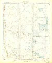
Miramonte Ranch, California, USGS topographic map dated 1930.
Includes geographic coordinates (latitude and longitude). This topographic map is suitable for hiking, camping, and exploring, or framing it as a wall map.
Printed on-demand using high resolution imagery, on heavy weight and acid free paper, or alternatively on a variety of synthetic materials.
Topos available on paper, Waterproof, Poly, or Tyvek. Usually shipping rolled, unless combined with other folded maps in one order.
- Product Number: USGS-5499703
- Free digital map download (high-resolution, GeoPDF): Miramonte Ranch, California (file size: 5 MB)
- Map Size: please refer to the dimensions of the GeoPDF map above
- Weight (paper map): ca. 55 grams
- Map Type: POD USGS Topographic Map
- Map Series: HTMC
- Map Verison: Historical
- Cell ID: 26657
- Scan ID: 296321
- Survey Year: 1927
- Datum: NAD
- Map Projection: Polyconic
- Map published by United States Geological Survey
- Map Language: English
- Scanner Resolution: 600 dpi
- Map Cell Name: Lost Hills NE
- Grid size: 7.5 X 7.5 Minute
- Date on map: 1930
- Map Scale: 1:31680
- Geographical region: California, United States
Neighboring Maps:
All neighboring USGS topo maps are available for sale online at a variety of scales.
Spatial coverage:
Topo map Miramonte Ranch, California, covers the geographical area associated the following places:
- Sierra Gun Club - Cole Ranch - Westfield Gun Club (historical) - Los Amigos Gun Club - Snow Goose Gun Club - Gilbreath Gun Club - Kern National Wildlife Refuge - Hollywoodvale Gun Club (historical) - Loscal Gun Club (historical) - Los Patos Gun Club - Gilbert Gun Club (historical) - Beverly Gun Club - Superior Gun Club - Gilbreath Brothers Duck Club Airport (historical) - Poso Creek Family Dairy - Boschma and Sons Dairy - Miramonte Ranch - El Cinco Gun Club - General Petroleum Gun Club (historical) - Sage Brush Well - Doyle Gun Club (historical) - Donald Duck Gun Club - Goose Lake Canal - Jim Hill Gun Club
- Map Area ID: AREA35.7535.625-119.625-119.5
- Northwest corner Lat/Long code: USGSNW35.75-119.625
- Northeast corner Lat/Long code: USGSNE35.75-119.5
- Southwest corner Lat/Long code: USGSSW35.625-119.625
- Southeast corner Lat/Long code: USGSSE35.625-119.5
- Northern map edge Latitude: 35.75
- Southern map edge Latitude: 35.625
- Western map edge Longitude: -119.625
- Eastern map edge Longitude: -119.5


