
~ East Brownsville TX topo map, 1:24000 scale, 7.5 X 7.5 Minute, Historical, 1930
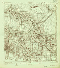
East Brownsville, Texas, USGS topographic map dated 1930.
Includes geographic coordinates (latitude and longitude). This topographic map is suitable for hiking, camping, and exploring, or framing it as a wall map.
Printed on-demand using high resolution imagery, on heavy weight and acid free paper, or alternatively on a variety of synthetic materials.
Topos available on paper, Waterproof, Poly, or Tyvek. Usually shipping rolled, unless combined with other folded maps in one order.
- Product Number: USGS-5485467
- Free digital map download (high-resolution, GeoPDF): East Brownsville, Texas (file size: 12 MB)
- Map Size: please refer to the dimensions of the GeoPDF map above
- Weight (paper map): ca. 55 grams
- Map Type: POD USGS Topographic Map
- Map Series: HTMC
- Map Verison: Historical
- Cell ID: 13343
- Scan ID: 123930
- Visual Version Number: 1
- Survey Year: 1930
- Datum: NAD
- Map Projection: Polyconic
- Advance: Yes
- Map published by United States Geological Survey
- Keywords: Nonstandard Press Run
- Map Language: English
- Scanner Resolution: 600 dpi
- Map Cell Name: East Brownsville
- Grid size: 7.5 X 7.5 Minute
- Date on map: 1930
- Map Scale: 1:24000
- Geographical region: Texas, United States
Neighboring Maps:
All neighboring USGS topo maps are available for sale online at a variety of scales.
Spatial coverage:
Topo map East Brownsville, Texas, covers the geographical area associated the following places:
- Houston Road East Colonia - Stewart Colonia - Los Cuates South Colonia - Coronado Colonia - Valle Escondido Colonia - Brownsville - Jaime Lake Colonia - FM 802-511 Colonia - Bautista Colonia - Kellers Corner Colonia - Dockberry Estates Colonia - Boca Chica and Medford Colonia - 21 Subdivision Colonia - Betty Acres Colonia - Cameron Park - Travis Road Colonia - Cielito Lindo Colonia - Saldivar Colonia - Villa Pancho Colonia - Cameron Park Colonia - Illinois Heights Colonia - Praxedis Saldivar Colonia - Barrios Colonia - Port Brownsville - Travis and Vermillion Colonia - Harris Tract Colonia - Central Estates Colonia - Four Corners - Reid Hope King Colonia - Villa Pancho - Dakota Mobile Home Park Colonia
- Map Area ID: AREA2625.875-97.5-97.375
- Northwest corner Lat/Long code: USGSNW26-97.5
- Northeast corner Lat/Long code: USGSNE26-97.375
- Southwest corner Lat/Long code: USGSSW25.875-97.5
- Southeast corner Lat/Long code: USGSSE25.875-97.375
- Northern map edge Latitude: 26
- Southern map edge Latitude: 25.875
- Western map edge Longitude: -97.5
- Eastern map edge Longitude: -97.375


