
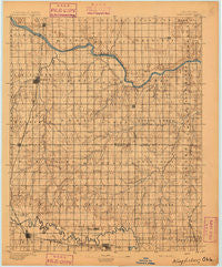
~ Kingfisher OK topo map, 1:125000 scale, 30 X 30 Minute, Historical, 1895
Kingfisher, Oklahoma, USGS topographic map dated 1895.
Includes geographic coordinates (latitude and longitude). This topographic map is suitable for hiking, camping, and exploring, or framing it as a wall map.
Printed on-demand using high resolution imagery, on heavy weight and acid free paper, or alternatively on a variety of synthetic materials.
Topos available on paper, Waterproof, Poly, or Tyvek. Usually shipping rolled, unless combined with other folded maps in one order.
- Product Number: USGS-5472929
- Free digital map download (high-resolution, GeoPDF): Kingfisher, Oklahoma (file size: 6 MB)
- Map Size: please refer to the dimensions of the GeoPDF map above
- Weight (paper map): ca. 55 grams
- Map Type: POD USGS Topographic Map
- Map Series: HTMC
- Map Verison: Historical
- Cell ID: 65808
- Scan ID: 802530
- Survey Year: 1892
- Datum: Unstated
- Map Projection: Unstated
- Map published by United States Geological Survey
- Map Language: English
- Scanner Resolution: 508 dpi
- Map Cell Name: Kingfisher
- Grid size: 30 X 30 Minute
- Date on map: 1895
- Map Scale: 1:125000
- Geographical region: Oklahoma, United States
Neighboring Maps:
All neighboring USGS topo maps are available for sale online at a variety of scales.
Spatial coverage:
Topo map Kingfisher, Oklahoma, covers the geographical area associated the following places:
- Twin Lakes - Nichols Hills - Richland - Whisler (historical) - Cimarron City - Woodlawn Park - Concho - Crescent - The Village - Kingfisher - Cashion - Cedar Valley - Warr Acres - Dover - Okarche - Reeding - Crescent Springs - Yukon - Britton - Indian Springs - Navina - El Reno - Piedmont - Banner - Bethany - Wandel - Zion (historical)
- Map Area ID: AREA3635.5-98-97.5
- Northwest corner Lat/Long code: USGSNW36-98
- Northeast corner Lat/Long code: USGSNE36-97.5
- Southwest corner Lat/Long code: USGSSW35.5-98
- Southeast corner Lat/Long code: USGSSE35.5-97.5
- Northern map edge Latitude: 36
- Southern map edge Latitude: 35.5
- Western map edge Longitude: -98
- Eastern map edge Longitude: -97.5


