
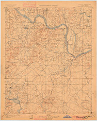
~ Okmulgee OK topo map, 1:125000 scale, 30 X 30 Minute, Historical, 1900
Okmulgee, Oklahoma, USGS topographic map dated 1900.
Includes geographic coordinates (latitude and longitude). This topographic map is suitable for hiking, camping, and exploring, or framing it as a wall map.
Printed on-demand using high resolution imagery, on heavy weight and acid free paper, or alternatively on a variety of synthetic materials.
Topos available on paper, Waterproof, Poly, or Tyvek. Usually shipping rolled, unless combined with other folded maps in one order.
- Product Number: USGS-5468453
- Free digital map download (high-resolution, GeoPDF): Okmulgee, Oklahoma (file size: 5 MB)
- Map Size: please refer to the dimensions of the GeoPDF map above
- Weight (paper map): ca. 55 grams
- Map Type: POD USGS Topographic Map
- Map Series: HTMC
- Map Verison: Historical
- Cell ID: 66238
- Scan ID: 802563
- Survey Year: 1896
- Datum: Unstated
- Map Projection: Unstated
- Map published by United States Geological Survey
- Map Language: English
- Scanner Resolution: 508 dpi
- Map Cell Name: Okmulgee
- Grid size: 30 X 30 Minute
- Date on map: 1900
- Map Scale: 1:125000
- Geographical region: Oklahoma, United States
Neighboring Maps:
All neighboring USGS topo maps are available for sale online at a variety of scales.
Spatial coverage:
Topo map Okmulgee, Oklahoma, covers the geographical area associated the following places:
- Gore - Hyde Park - Metory - Pumpkin Center - Mallard Bay - McLain - Martin - Hulbert - Webbers Falls - Braggs - Hy 10 Landing - West Muskogee - White Oak - Aqua Park - Grandview Heights - Thompson Corner - Taylor Ferry - Manard - Creek Agency (historical) - Tullahassee - Oktaha - Muskogee - Wybark - Lost City - Gabriel - Carlisle - Zeb - Summit - Wagoner - Keefton - Toppers - Shady Grove - Woodall - Qualls - Gore Landing - Notiechtown - Redbird Smith - Anchor - Fort Gibson - Eli - Crekola - Rentiesville - Okay - Gibson - Bacone - Shopton - Paradise Hill
- Map Area ID: AREA3635.5-95.5-95
- Northwest corner Lat/Long code: USGSNW36-95.5
- Northeast corner Lat/Long code: USGSNE36-95
- Southwest corner Lat/Long code: USGSSW35.5-95.5
- Southeast corner Lat/Long code: USGSSE35.5-95
- Northern map edge Latitude: 36
- Southern map edge Latitude: 35.5
- Western map edge Longitude: -95.5
- Eastern map edge Longitude: -95


