
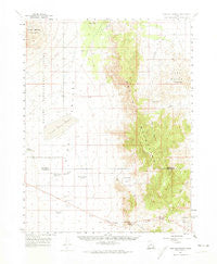
~ Wah Wah Summit UT topo map, 1:62500 scale, 15 X 15 Minute, Historical, 1960, updated 1974
Wah Wah Summit, Utah, USGS topographic map dated 1960.
Includes geographic coordinates (latitude and longitude). This topographic map is suitable for hiking, camping, and exploring, or framing it as a wall map.
Printed on-demand using high resolution imagery, on heavy weight and acid free paper, or alternatively on a variety of synthetic materials.
Topos available on paper, Waterproof, Poly, or Tyvek. Usually shipping rolled, unless combined with other folded maps in one order.
- Product Number: USGS-5463023
- Free digital map download (high-resolution, GeoPDF): Wah Wah Summit, Utah (file size: 7 MB)
- Map Size: please refer to the dimensions of the GeoPDF map above
- Weight (paper map): ca. 55 grams
- Map Type: POD USGS Topographic Map
- Map Series: HTMC
- Map Verison: Historical
- Cell ID: 64157
- Scan ID: 252623
- Imprint Year: 1974
- Woodland Tint: Yes
- Aerial Photo Year: 1953
- Survey Year: 1960
- Datum: NAD27
- Map Projection: Polyconic
- Map published by United States Geological Survey
- Map Language: English
- Scanner Resolution: 600 dpi
- Map Cell Name: Wah Wah Summit
- Grid size: 15 X 15 Minute
- Date on map: 1960
- Map Scale: 1:62500
- Geographical region: Utah, United States
Neighboring Maps:
All neighboring USGS topo maps are available for sale online at a variety of scales.
Spatial coverage:
Topo map Wah Wah Summit, Utah, covers the geographical area associated the following places:
- Desert Ranch Reservoir - Desert Range Experimental Station Headquarters - Corral Canyon - Eye of Needle - Wah Wah Summit - Sols Knoll - Pierce Canyon - Electric Fence Reservoir - Lawson Cove Canyon - Guyman Well - Lime Point - Upper Pass - Pierson Cove - Range Headquarters - Pine Valley Hardpan - Cow Camp Well - Grassy Cove - Middle Pass - Cow Track Reservoir
- Map Area ID: AREA38.7538.5-113.75-113.5
- Northwest corner Lat/Long code: USGSNW38.75-113.75
- Northeast corner Lat/Long code: USGSNE38.75-113.5
- Southwest corner Lat/Long code: USGSSW38.5-113.75
- Southeast corner Lat/Long code: USGSSE38.5-113.5
- Northern map edge Latitude: 38.75
- Southern map edge Latitude: 38.5
- Western map edge Longitude: -113.75
- Eastern map edge Longitude: -113.5


