
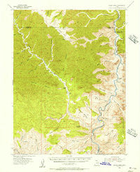
~ Range Creek UT topo map, 1:62500 scale, 15 X 15 Minute, Historical, 1954, updated 1956
Range Creek, Utah, USGS topographic map dated 1954.
Includes geographic coordinates (latitude and longitude). This topographic map is suitable for hiking, camping, and exploring, or framing it as a wall map.
Printed on-demand using high resolution imagery, on heavy weight and acid free paper, or alternatively on a variety of synthetic materials.
Topos available on paper, Waterproof, Poly, or Tyvek. Usually shipping rolled, unless combined with other folded maps in one order.
- Product Number: USGS-5462835
- Free digital map download (high-resolution, GeoPDF): Range Creek, Utah (file size: 10 MB)
- Map Size: please refer to the dimensions of the GeoPDF map above
- Weight (paper map): ca. 55 grams
- Map Type: POD USGS Topographic Map
- Map Series: HTMC
- Map Verison: Historical
- Cell ID: 61445
- Scan ID: 251460
- Imprint Year: 1956
- Woodland Tint: Yes
- Aerial Photo Year: 1951
- Field Check Year: 1954
- Datum: NAD27
- Map Projection: Polyconic
- Map published by United States Geological Survey
- Map Language: English
- Scanner Resolution: 600 dpi
- Map Cell Name: Range Creek
- Grid size: 15 X 15 Minute
- Date on map: 1954
- Map Scale: 1:62500
- Geographical region: Utah, United States
Neighboring Maps:
All neighboring USGS topo maps are available for sale online at a variety of scales.
Spatial coverage:
Topo map Range Creek, Utah, covers the geographical area associated the following places:
- Turtle Canyon - Barton Canyon - Jacks Hole - Joe Hatch Canyon - Coal Creek Rapids - Boulder Mesa - Pinnacle Mesa - Mitchs Canyon - Range Creek Rapids - Billy Slope Canyon - Xmas Mountain - Three Fords Benches - Red Point Rapids - Pilling Ranch - Three Fords Rapids - Joe Hutch Canyon Rapids - Joe Hutch Creek Rapids - Spring Wash Canyon - Red Point - Bluebell Creek - Beaver Slide Rim - Chandler Canyon - Xmas Canyon - Jacks Rock - Rabbit Valley Rapids - Joe Hutch Creek - Nelson Canyon - Joe Spring - Wire Fence Canyon - Curry Rapids - Big Canyon - Dilly Canyon - Desolation Canyon - Three Fords Canyon - Cherry Meadow Canyon - Sheep Canyon - Cherry Meadow - Last Chance Rapids - Little Horse Canyon - Three Golden Stairs - Lighthouse Canyon - Wilcox Ranch - Bear Canyon - Moonwater Rapids - Last Chance Canyon - Curry Canyon - Trail Canyon - Saleratus Rapids - Bull Canyon - Three Fords Canyon - Calf Canyon - Chandler Falls - Dry Canyon - Saleratus Canyon - Florence Creek - Rain Canyon - Beaver Slide Bottom - Last Chance Benches - McPherson Ranch - Coal Creek - Rabbit Valley - Trail Canyon Rapids - Range Creek Canyon - Three Canyon - Range Creek - Lion Hollow - Bull Canyon Rapids
- Map Area ID: AREA39.539.25-110.25-110
- Northwest corner Lat/Long code: USGSNW39.5-110.25
- Northeast corner Lat/Long code: USGSNE39.5-110
- Southwest corner Lat/Long code: USGSSW39.25-110.25
- Southeast corner Lat/Long code: USGSSE39.25-110
- Northern map edge Latitude: 39.5
- Southern map edge Latitude: 39.25
- Western map edge Longitude: -110.25
- Eastern map edge Longitude: -110


