
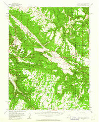
~ Lisbon Valley UT topo map, 1:62500 scale, 15 X 15 Minute, Historical, 1954, updated 1961
Lisbon Valley, Utah, USGS topographic map dated 1954.
Includes geographic coordinates (latitude and longitude). This topographic map is suitable for hiking, camping, and exploring, or framing it as a wall map.
Printed on-demand using high resolution imagery, on heavy weight and acid free paper, or alternatively on a variety of synthetic materials.
Topos available on paper, Waterproof, Poly, or Tyvek. Usually shipping rolled, unless combined with other folded maps in one order.
- Product Number: USGS-5462601
- Free digital map download (high-resolution, GeoPDF): Lisbon Valley, Utah (file size: 9 MB)
- Map Size: please refer to the dimensions of the GeoPDF map above
- Weight (paper map): ca. 55 grams
- Map Type: POD USGS Topographic Map
- Map Series: HTMC
- Map Verison: Historical
- Cell ID: 56763
- Scan ID: 250303
- Imprint Year: 1961
- Woodland Tint: Yes
- Aerial Photo Year: 1953
- Field Check Year: 1954
- Datum: NAD27
- Map Projection: Polyconic
- Map published by United States Geological Survey
- Map Language: English
- Scanner Resolution: 600 dpi
- Map Cell Name: Lisbon Valley
- Grid size: 15 X 15 Minute
- Date on map: 1954
- Map Scale: 1:62500
- Geographical region: Utah, United States
Neighboring Maps:
All neighboring USGS topo maps are available for sale online at a variety of scales.
Spatial coverage:
Topo map Lisbon Valley, Utah, covers the geographical area associated the following places:
- Lisbon Gap - Summit Point - East Coyote Wash - White Cow Mine - Cowhand Mine - Wild Horse Draw - Snyder Water Canyon - Big Indian Rock - Moosey Canyon - Island Mesa - Civet Cat Group Mine - Roberta Lee Mine - Greasewood Canyon - La Salle Mine - West Summit - Horsethief Canyon - Jackie Walls Mine - Little Valley - Iron Spring Canyon - Huntley Spring - Cuba Mine - Bullhorn Wash - Happy Jack Mine - Vanadium Queen Mine - Bugwine Mine - Lower Lisbon Valley - Big Indian Valley - Sop Canyon - Deerneck Mesa - Pine Hollow - Sop Spring - Lisbon Canyon - West Summit School - East Canyon Wash - Greasewood Canyon - Buck Draw - Iron Canyon Point - Louise Mine - Bear Trap Canyon - Cub Mine - Ava Jay Mine - Moosey Point - Cone Mine - Island Canyon - Island Mesa - South Canyon - Ada Bell Mine - Lisbon Spring - Radar Mine - Big Buck One Mine - Three Step Hill - Lisbon Valley - Middle Mesa - Red Lake Canyon - Little Indian Canyon - Rim Canyon Mine
- Map Area ID: AREA38.2538-109.25-109
- Northwest corner Lat/Long code: USGSNW38.25-109.25
- Northeast corner Lat/Long code: USGSNE38.25-109
- Southwest corner Lat/Long code: USGSSW38-109.25
- Southeast corner Lat/Long code: USGSSE38-109
- Northern map edge Latitude: 38.25
- Southern map edge Latitude: 38
- Western map edge Longitude: -109.25
- Eastern map edge Longitude: -109


