
~ Frisco Peak UT topo map, 1:62500 scale, 15 X 15 Minute, Historical, 1960, updated 1962
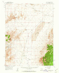
Frisco Peak, Utah, USGS topographic map dated 1960.
Includes geographic coordinates (latitude and longitude). This topographic map is suitable for hiking, camping, and exploring, or framing it as a wall map.
Printed on-demand using high resolution imagery, on heavy weight and acid free paper, or alternatively on a variety of synthetic materials.
Topos available on paper, Waterproof, Poly, or Tyvek. Usually shipping rolled, unless combined with other folded maps in one order.
- Product Number: USGS-5462451
- Free digital map download (high-resolution, GeoPDF): Frisco Peak, Utah (file size: 7 MB)
- Map Size: please refer to the dimensions of the GeoPDF map above
- Weight (paper map): ca. 55 grams
- Map Type: POD USGS Topographic Map
- Map Series: HTMC
- Map Verison: Historical
- Cell ID: 54417
- Scan ID: 249424
- Imprint Year: 1962
- Woodland Tint: Yes
- Aerial Photo Year: 1953
- Survey Year: 1960
- Datum: NAD27
- Map Projection: Polyconic
- Map published by United States Geological Survey
- Map Language: English
- Scanner Resolution: 600 dpi
- Map Cell Name: Frisco Peak
- Grid size: 15 X 15 Minute
- Date on map: 1960
- Map Scale: 1:62500
- Geographical region: Utah, United States
Neighboring Maps:
All neighboring USGS topo maps are available for sale online at a variety of scales.
Spatial coverage:
Topo map Frisco Peak, Utah, covers the geographical area associated the following places:
- Indian Queen Mine - Brown Knoll - Wah Wah Well - Pitchforth Spring - Wild Horse Corral - East Hardpan Reservoir - Long Valley - Wah Wah Valley Hardpan - Bagnall Corral - Tow Rock Charcoal Kilns - Nielson Pond - San Francisco Mountains - Kelleys Place - Golden Reef Mine - Wah Wah Cove - Wah Wah Valley - Newhouse Reservoir - Lawson Cove - Crystal Spring - Barrel Spring Canyon - Fifteenmile Point - Tub Spring - Two Rock Charcoal Kilns (historical) - Wah Wah Wash - Dutchman Reservoir - Lawson Cove Reservoir - Indian Queen Reservoir - Morehouse Spring - Gray Hills - Frisco Peak - Horse Spring
- Map Area ID: AREA38.7538.5-113.5-113.25
- Northwest corner Lat/Long code: USGSNW38.75-113.5
- Northeast corner Lat/Long code: USGSNE38.75-113.25
- Southwest corner Lat/Long code: USGSSW38.5-113.5
- Southeast corner Lat/Long code: USGSSE38.5-113.25
- Northern map edge Latitude: 38.75
- Southern map edge Latitude: 38.5
- Western map edge Longitude: -113.5
- Eastern map edge Longitude: -113.25


