
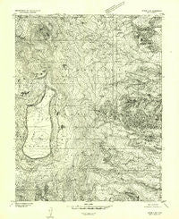
~ Notom 2 NW UT topo map, 1:24000 scale, 7.5 X 7.5 Minute, Historical, 1952, updated 1954
Notom 2 NW, Utah, USGS topographic map dated 1952.
Includes geographic coordinates (latitude and longitude). This topographic map is suitable for hiking, camping, and exploring, or framing it as a wall map.
Printed on-demand using high resolution imagery, on heavy weight and acid free paper, or alternatively on a variety of synthetic materials.
Topos available on paper, Waterproof, Poly, or Tyvek. Usually shipping rolled, unless combined with other folded maps in one order.
- Product Number: USGS-5459635
- Free digital map download (high-resolution, GeoPDF): Notom 2 NW, Utah (file size: 14 MB)
- Map Size: please refer to the dimensions of the GeoPDF map above
- Weight (paper map): ca. 55 grams
- Map Type: POD USGS Topographic Map
- Map Series: HTMC
- Map Verison: Historical
- Cell ID: 15502
- Scan ID: 251026
- Imprint Year: 1954
- Aerial Photo Year: 1951
- Datum: Unstated
- Map Projection: Unstated
- Preliminary map: Yes
- Map published by United States Geological Survey
- Keywords: Nonstandard Press Run
- Map Language: English
- Scanner Resolution: 600 dpi
- Map Cell Name: Flat Top
- Grid size: 7.5 X 7.5 Minute
- Date on map: 1952
- Map Scale: 1:24000
- Geographical region: Utah, United States
Neighboring Maps:
All neighboring USGS topo maps are available for sale online at a variety of scales.
Spatial coverage:
Topo map Notom 2 NW, Utah, covers the geographical area associated the following places:
- Sidehill Spring - Elkhorn Ranger Station and Forest Camp - Neff Reservoir - Indian Spring - Neffs Reservoir - Sulphur Spring - Bull Run Flat - Point Lookout - Wiffs Pasture - Pine Spring - Sulphur Basin - Alex Spring - Chaffin Spring - Deep Creek Lake - McDonld Basin - Blue Lake - Thousand Lake Mountain - East Sand Creek Spring - Round Lake Springs - Polk Creek Ridge - Jahu Flat - Deep Creek Spring - Elkhorn Campground - Neffs Dam - Indian Spring - Hens Peak Spring - Flat Top - Heart Lake - Flat Top Spring - Deep Creek Ridge - Hens Hole Peak - Hens Hole Flat - Tub Flat - Sawmill Spring - Elkhorn Guard Station - Round Lake - Bullings Pass - Sand Creek Spring - Snow Lake - Billings Pass - Upper Deep Creek Spring - Hickman Spring - Bullberry Flat - Clay Dugway Spring - Heart Lake - Mud Spring - Sand Flat
- Map Area ID: AREA38.538.375-111.5-111.375
- Northwest corner Lat/Long code: USGSNW38.5-111.5
- Northeast corner Lat/Long code: USGSNE38.5-111.375
- Southwest corner Lat/Long code: USGSSW38.375-111.5
- Southeast corner Lat/Long code: USGSSE38.375-111.375
- Northern map edge Latitude: 38.5
- Southern map edge Latitude: 38.375
- Western map edge Longitude: -111.5
- Eastern map edge Longitude: -111.375


