
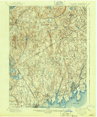
~ Stamford CT topo map, 1:62500 scale, 15 X 15 Minute, Historical, 1899, updated 1943
Stamford, Connecticut, USGS topographic map dated 1899.
Includes geographic coordinates (latitude and longitude). This topographic map is suitable for hiking, camping, and exploring, or framing it as a wall map.
Printed on-demand using high resolution imagery, on heavy weight and acid free paper, or alternatively on a variety of synthetic materials.
Topos available on paper, Waterproof, Poly, or Tyvek. Usually shipping rolled, unless combined with other folded maps in one order.
- Product Number: USGS-5453975
- Free digital map download (high-resolution, GeoPDF): Stamford, Connecticut (file size: 9 MB)
- Map Size: please refer to the dimensions of the GeoPDF map above
- Weight (paper map): ca. 55 grams
- Map Type: POD USGS Topographic Map
- Map Series: HTMC
- Map Verison: Historical
- Cell ID: 320812
- Scan ID: 139871
- Imprint Year: 1943
- Datum: Unstated
- Map Projection: Polyconic
- Map published by United States Geological Survey
- Map Language: English
- Scanner Resolution: 600 dpi
- Map Cell Name: Stamford
- Grid size: 15 X 15 Minute
- Date on map: 1899
- Map Scale: 1:62500
- Geographical region: Connecticut, United States
Neighboring Maps:
All neighboring USGS topo maps are available for sale online at a variety of scales.
Spatial coverage:
Topo map Stamford, Connecticut, covers the geographical area associated the following places:
- Stanwood - Byram - Springdale - Dolphin Cove - East White Plains - Palmers Hill - Banksville - Hunting Ridge - Willisville (historical) - Glenbrook - Sarles Corners - Stamford - Purchase - North Mianus - Millville (historical) - Roxbury - North Stamford - Belltown - North Greenwich - Pine Hill - Mount Kisco - South End - Newfield - Bedford - Long Ridge - Westcott (historical) - Pinneys Corners - East Port Chester (historical) - Rye Brook - Sellecks Corners - Cos Cob - Glenville - Mianus - Riverside - Turn of River - Sarosca Farm Estates - Kirbyville - Scotts Corners - Bedford Center - Bedford Hills - Shippan Point - Ridgeway - Old Greenwich - Vista - Rock Ridge - Port Chester - Bedford Four Corners - Horseshoe Hill - North Castle - Armonk - High Ridge - High Ridge - Belle Haven - Pemberwick - Ponus - East Woods - Riverbank - Windmill Farm - Pound Ridge - Riversville - Stanwich - Greenwich - Lewisboro - North Mianus - Northfield
- Map Area ID: AREA41.2541-73.75-73.5
- Northwest corner Lat/Long code: USGSNW41.25-73.75
- Northeast corner Lat/Long code: USGSNE41.25-73.5
- Southwest corner Lat/Long code: USGSSW41-73.75
- Southeast corner Lat/Long code: USGSSE41-73.5
- Northern map edge Latitude: 41.25
- Southern map edge Latitude: 41
- Western map edge Longitude: -73.75
- Eastern map edge Longitude: -73.5


