
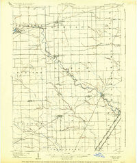
~ Romulus MI topo map, 1:62500 scale, 15 X 15 Minute, Historical, 1906, updated 1926
Romulus, Michigan, USGS topographic map dated 1906.
Includes geographic coordinates (latitude and longitude). This topographic map is suitable for hiking, camping, and exploring, or framing it as a wall map.
Printed on-demand using high resolution imagery, on heavy weight and acid free paper, or alternatively on a variety of synthetic materials.
Topos available on paper, Waterproof, Poly, or Tyvek. Usually shipping rolled, unless combined with other folded maps in one order.
- Product Number: USGS-5443228
- Free digital map download (high-resolution, GeoPDF): Romulus, Michigan (file size: 5 MB)
- Map Size: please refer to the dimensions of the GeoPDF map above
- Weight (paper map): ca. 55 grams
- Map Type: POD USGS Topographic Map
- Map Series: HTMC
- Map Verison: Historical
- Cell ID: 54167
- Scan ID: 278461
- Imprint Year: 1926
- Survey Year: 1903
- Datum: NAD
- Map Projection: Polyconic
- Map published by United States Geological Survey
- Map Language: English
- Scanner Resolution: 600 dpi
- Map Cell Name: Flat Rock
- Grid size: 15 X 15 Minute
- Date on map: 1906
- Map Scale: 1:62500
- Geographical region: Michigan, United States
Neighboring Maps:
All neighboring USGS topo maps are available for sale online at a variety of scales.
Spatial coverage:
Topo map Romulus, Michigan, covers the geographical area associated the following places:
- Belleville North - Waltz - French Landing - Martinsville - Carleton - Newport Farms Mobile Home Community - New Boston - French Town Villa Mobile Home Park - Taylor - Romulus - Scofield - Flat Rock - Newport - Belleville - Willow - Grafton - Flat Rock Village Mobile Home Park - Carleton Mobile Home Park - Yorkshire Manor Mobile Home Park - Taylor Center - Roulo - South Rockwood - Exeter (historical)
- Map Area ID: AREA42.2542-83.5-83.25
- Northwest corner Lat/Long code: USGSNW42.25-83.5
- Northeast corner Lat/Long code: USGSNE42.25-83.25
- Southwest corner Lat/Long code: USGSSW42-83.5
- Southeast corner Lat/Long code: USGSSE42-83.25
- Northern map edge Latitude: 42.25
- Southern map edge Latitude: 42
- Western map edge Longitude: -83.5
- Eastern map edge Longitude: -83.25


