
~ Houghton MI topo map, 1:62500 scale, 15 X 15 Minute, Historical, 1915, updated 1947
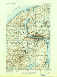
Houghton, Michigan, USGS topographic map dated 1915.
Includes geographic coordinates (latitude and longitude). This topographic map is suitable for hiking, camping, and exploring, or framing it as a wall map.
Printed on-demand using high resolution imagery, on heavy weight and acid free paper, or alternatively on a variety of synthetic materials.
Topos available on paper, Waterproof, Poly, or Tyvek. Usually shipping rolled, unless combined with other folded maps in one order.
- Product Number: USGS-5442792
- Free digital map download (high-resolution, GeoPDF): Houghton, Michigan (file size: 9 MB)
- Map Size: please refer to the dimensions of the GeoPDF map above
- Weight (paper map): ca. 55 grams
- Map Type: POD USGS Topographic Map
- Map Series: HTMC
- Map Verison: Historical
- Cell ID: 55504
- Scan ID: 278214
- Imprint Year: 1947
- Survey Year: 1912
- Datum: Unstated
- Map Projection: Polyconic
- Map published by United States Geological Survey
- Map Language: English
- Scanner Resolution: 600 dpi
- Map Cell Name: Houghton
- Grid size: 15 X 15 Minute
- Date on map: 1915
- Map Scale: 1:62500
- Geographical region: Michigan, United States
Neighboring Maps:
All neighboring USGS topo maps are available for sale online at a variety of scales.
Spatial coverage:
Topo map Houghton, Michigan, covers the geographical area associated the following places:
- Trimountain - Pilgrim - Salmon Trout - South Range - Chassell - Dollar Bay - Pewabic - Birch Grove Mobile Home Park - Baltic - Franklin Mine - Boston - Atlantic Mine - Mill Mine Junction - Sunshine Beach - Lewer Pewabic - Paavola - Ripley - Hurontown - Dodgeville - Chassell Bay Cabins Mobile Home Park - Houghton - Schmidt Corner - Oskar - Superior - Liminga - Hancock - Arcadian - Champion Mine - Painesdale
- Map Area ID: AREA47.2547-88.75-88.5
- Northwest corner Lat/Long code: USGSNW47.25-88.75
- Northeast corner Lat/Long code: USGSNE47.25-88.5
- Southwest corner Lat/Long code: USGSSW47-88.75
- Southeast corner Lat/Long code: USGSSE47-88.5
- Northern map edge Latitude: 47.25
- Southern map edge Latitude: 47
- Western map edge Longitude: -88.75
- Eastern map edge Longitude: -88.5


