
~ Pasadena Valley ID topo map, 1:62500 scale, 15 X 15 Minute, Historical, 1949, updated 1952
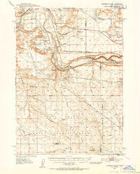
Pasadena Valley, Idaho, USGS topographic map dated 1949.
Includes geographic coordinates (latitude and longitude). This topographic map is suitable for hiking, camping, and exploring, or framing it as a wall map.
Printed on-demand using high resolution imagery, on heavy weight and acid free paper, or alternatively on a variety of synthetic materials.
Topos available on paper, Waterproof, Poly, or Tyvek. Usually shipping rolled, unless combined with other folded maps in one order.
- Product Number: USGS-5437410
- Free digital map download (high-resolution, GeoPDF): Pasadena Valley, Idaho (file size: 8 MB)
- Map Size: please refer to the dimensions of the GeoPDF map above
- Weight (paper map): ca. 55 grams
- Map Type: POD USGS Topographic Map
- Map Series: HTMC
- Map Verison: Historical
- Cell ID: 60787
- Scan ID: 239226
- Imprint Year: 1952
- Aerial Photo Year: 1946
- Survey Year: 1949
- Datum: NAD27
- Map Projection: Polyconic
- Map published by United States Geological Survey
- Map Language: English
- Scanner Resolution: 600 dpi
- Map Cell Name: Pasadena Valley
- Grid size: 15 X 15 Minute
- Date on map: 1949
- Map Scale: 1:62500
- Geographical region: Idaho, United States
Neighboring Maps:
All neighboring USGS topo maps are available for sale online at a variety of scales.
Spatial coverage:
Topo map Pasadena Valley, Idaho, covers the geographical area associated the following places:
- Burnt Ridge - Tuana Gulch - Cassia Gulch - Swiss Valley - Flint Mesa - Bliss Reservoir - Frog Hollow - Black Mesa - Lateral Y-9 - Pilgrim Spring - Ticeska - The Pasture - Cassia Canal - Deer Gulch - King Hill Main Canal - Pioneer Butte - Pioneer Reservoir - Lateral Y-8 - Little Pilgrim Gulch - Ticeska Station - Tuana Canal - Indian Butte - Bliss Dam - Clover Creek - Basin Lateral - Sugar Bowl - Bliss Dam - Big Pilgrim Gulch - Sunleaf Siphon (historical) - Pasadena Valley School - Gopher Knoll - Basin Siphon - Taylor Dam - Pasadena Valley - King Hill Creek - King Hill Lateral - Lateral Y-12 - Pioneer Dam - Tuana Spring - Pilgrim Stage Station Historic Site - Twentymile Butte - Bancroft Springs - Jolley Flat
- Map Area ID: AREA4342.75-115.25-115
- Northwest corner Lat/Long code: USGSNW43-115.25
- Northeast corner Lat/Long code: USGSNE43-115
- Southwest corner Lat/Long code: USGSSW42.75-115.25
- Southeast corner Lat/Long code: USGSSE42.75-115
- Northern map edge Latitude: 43
- Southern map edge Latitude: 42.75
- Western map edge Longitude: -115.25
- Eastern map edge Longitude: -115


