
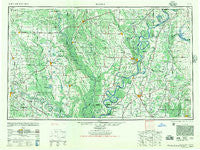
~ Helena AR topo map, 1:250000 scale, 1 X 2 Degree, Historical, 1948
Helena, Arkansas, USGS topographic map dated 1948.
Includes geographic coordinates (latitude and longitude). This topographic map is suitable for hiking, camping, and exploring, or framing it as a wall map.
Printed on-demand using high resolution imagery, on heavy weight and acid free paper, or alternatively on a variety of synthetic materials.
Topos available on paper, Waterproof, Poly, or Tyvek. Usually shipping rolled, unless combined with other folded maps in one order.
- Product Number: USGS-5430112
- Free digital map download (high-resolution, GeoPDF): Helena, Arkansas (file size: 22 MB)
- Map Size: please refer to the dimensions of the GeoPDF map above
- Weight (paper map): ca. 55 grams
- Map Type: POD USGS Topographic Map
- Map Series: HTMC
- Map Verison: Historical
- Cell ID: 68822
- Scan ID: 260596
- Woodland Tint: Yes
- Aerial Photo Year: 1945
- Datum: NAD27
- Map Projection: Transverse Mercator
- Map published by United States Army Corps of Engineers
- Map published by United States Army
- Map Language: English
- Scanner Resolution: 600 dpi
- Map Cell Name: Helena
- Grid size: 1 X 2 Degree
- Date on map: 1948
- Map Scale: 1:250000
- Geographical region: Arkansas, United States
Neighboring Maps:
All neighboring USGS topo maps are available for sale online at a variety of scales.
Spatial coverage:
Topo map Helena, Arkansas, covers the geographical area associated the following places:
- Tuni - Hinchcliff - Smale - Ewal - West Days - Buffo (historical) - Crowder - Sessions - Southwood Addition - Nash Corner - Robinsonville - Vanness Crossing - Rochdale - Lyon - Haynes - Sycamore Bend Farm - De Soto Village - Yarbrough - Harrs Place (historical) - Gethsemane - Knowlton - Allport - Smith Corner - Roseacres - Lakeview - New Gascony - Arkansas (historical) - Fourmile Corner - Plunketts - Horatio - Douglas - English - Tomberlin - Hally - Anrep (historical) - Edgewood - Marianna - Lamberts (historical) - Penton - Abeles (historical) - Preston Place - Sherrill - Cooper Addition - Turkey Scratch - Lambert - Essex - Evergreen Place - Aubrey - Peppers Landing - Westor - Hushpuckena - Clements (historical) - Canaan - Windwood Heights - Goode - Haleside - Boyd (historical) - Highland Farm - Monroe - Thurman - Askew - Reese - Willis - Hiram - Varner - Preston Ferry - Mary Spur - Brickeys - Pleasant Hill - Woodiel Acres - Longino - Marvell - Redfern - Coahoma - Friars Point - Whisperwood - Raymond (historical) - Ingram (historical) - Reydell - Oak Forest - Darling - Thompson Grove - Round Lake - Stuttgart - Meto - Erwin - Riverton - Glover - Vance - Hugo (historical) - Noble Lake - Shannondale - Harrys - Commerce Landing - Robertsville (historical) - Southland - Red Gum Farm - Postelle - Helena - Linn (historical)
- Map Area ID: AREA3534-92-90
- Northwest corner Lat/Long code: USGSNW35-92
- Northeast corner Lat/Long code: USGSNE35-90
- Southwest corner Lat/Long code: USGSSW34-92
- Southeast corner Lat/Long code: USGSSE34-90
- Northern map edge Latitude: 35
- Southern map edge Latitude: 34
- Western map edge Longitude: -92
- Eastern map edge Longitude: -90


