
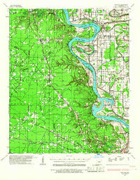
~ Pastoria AR topo map, 1:62500 scale, 15 X 15 Minute, Historical, 1932, updated 1967
Pastoria, Arkansas, USGS topographic map dated 1932.
Includes geographic coordinates (latitude and longitude). This topographic map is suitable for hiking, camping, and exploring, or framing it as a wall map.
Printed on-demand using high resolution imagery, on heavy weight and acid free paper, or alternatively on a variety of synthetic materials.
Topos available on paper, Waterproof, Poly, or Tyvek. Usually shipping rolled, unless combined with other folded maps in one order.
- Product Number: USGS-5429526
- Free digital map download (high-resolution, GeoPDF): Pastoria, Arkansas (file size: 8 MB)
- Map Size: please refer to the dimensions of the GeoPDF map above
- Weight (paper map): ca. 55 grams
- Map Type: POD USGS Topographic Map
- Map Series: HTMC
- Map Verison: Historical
- Cell ID: 60798
- Scan ID: 260243
- Imprint Year: 1967
- Woodland Tint: Yes
- Edit Year: 1935
- Datum: NAD27
- Map Projection: Polyconic
- Map published by United States Army Corps of Engineers
- Map Language: English
- Scanner Resolution: 600 dpi
- Map Cell Name: Pastoria
- Grid size: 15 X 15 Minute
- Date on map: 1932
- Map Scale: 1:62500
- Geographical region: Arkansas, United States
Neighboring Maps:
All neighboring USGS topo maps are available for sale online at a variety of scales.
Spatial coverage:
Topo map Pastoria, Arkansas, covers the geographical area associated the following places:
- Clear Lake - White Hall - College Park (historical) - English Place - Lamb (historical) - Plum Bayou (historical) - Hardin - Warbritton - Donaldsonville - Bruce (historical) - Redfield - Amber (historical) - Baldwin - Samples - Henslee Heights - Plain View - Midway - Eastwood - Kearney - Leitner - Jefferson - Wright - Oakland Heights - Dexter - Red Bluff (historical) - Pastoria - Doylestown - Walnut Ridge
- Map Area ID: AREA34.534.25-92.25-92
- Northwest corner Lat/Long code: USGSNW34.5-92.25
- Northeast corner Lat/Long code: USGSNE34.5-92
- Southwest corner Lat/Long code: USGSSW34.25-92.25
- Southeast corner Lat/Long code: USGSSE34.25-92
- Northern map edge Latitude: 34.5
- Southern map edge Latitude: 34.25
- Western map edge Longitude: -92.25
- Eastern map edge Longitude: -92


