
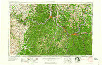
~ Huntington WV topo map, 1:250000 scale, 1 X 2 Degree, Historical, 1960, updated 1960
Huntington, West Virginia, USGS topographic map dated 1960.
Includes geographic coordinates (latitude and longitude). This topographic map is suitable for hiking, camping, and exploring, or framing it as a wall map.
Printed on-demand using high resolution imagery, on heavy weight and acid free paper, or alternatively on a variety of synthetic materials.
Topos available on paper, Waterproof, Poly, or Tyvek. Usually shipping rolled, unless combined with other folded maps in one order.
- Product Number: USGS-5416212
- Free digital map download (high-resolution, GeoPDF): Huntington, West Virginia (file size: 27 MB)
- Map Size: please refer to the dimensions of the GeoPDF map above
- Weight (paper map): ca. 55 grams
- Map Type: POD USGS Topographic Map
- Map Series: HTMC
- Map Verison: Historical
- Cell ID: 68832
- Scan ID: 254041
- Imprint Year: 1960
- Woodland Tint: Yes
- Field Check Year: 1957
- Datum: Unstated
- Map Projection: Transverse Mercator
- Map published by United States Army
- Map Language: English
- Scanner Resolution: 600 dpi
- Map Cell Name: Huntington
- Grid size: 1 X 2 Degree
- Date on map: 1960
- Map Scale: 1:250000
- Geographical region: West Virginia, United States
Neighboring Maps:
All neighboring USGS topo maps are available for sale online at a variety of scales.
Spatial coverage:
Topo map Huntington, West Virginia, covers the geographical area associated the following places:
- Oakview Heights - Salt Lick - Needmore (historical) - Eggleton - Fitch - Westmoreland - Ranger - Ironville - Wilson - Clearview - McCoy - Eden Park (historical) - Greer - Heights - Hewlet - Miller Estates - Hiett - Rock Camp - Hobson - Lake Washington - Coryville - Walbridge - Overda - Clems Shady Nook Park - Elliottville - Germantown - East Lynn - Bradrick - Owens Crossing - Johns Creek (historical) - Upper Indian Creek (historical) - Redoak - Green Valley (historical) - Abigail - Deevert - Toney - Tynrhos (historical) - Barboursville - Boggs (historical) - Plumville - Ault - Silica (historical) - Lakeland - Beale - Rosedale (historical) - Rocky Hill - East Fork (historical) - Newcombe - Kirkville - Antioch Church (historical) - Plummers Landing - Fort Gay - Good Hope - Green Bottom - Meadowbrook - Mohrtown - Mount Hope (historical) - Halcom - Riverview Mobile Home Park - Jacksonville - Cowan - Portsmouth - Condee (historical) - Denton - Gallia - Altizer - White Oak Valley - Slocum Heights - Rarden - Five Forks - Mays Lick - Park Lake Resort (historical) - Pea Ridge (historical) - Russellville - Keystone - Mount Carmel - Stout - Catbird - Colony Mobile Home Park - Silver Run - Hurricane Bridge (historical) - Harris - Sarah - Pebble - Neal - Fair Oaks - Fernleaf - Bell City - Black Sulpher Spring (historical) - Modern Mobile Home Park - Queens - Morgan Center - Leisure - Peniel - Oldtown (historical) - Crown City - Lecta - Big Sandy Junction - Essex - Farmville (historical)
- Map Area ID: AREA3938-84-82
- Northwest corner Lat/Long code: USGSNW39-84
- Northeast corner Lat/Long code: USGSNE39-82
- Southwest corner Lat/Long code: USGSSW38-84
- Southeast corner Lat/Long code: USGSSE38-82
- Northern map edge Latitude: 39
- Southern map edge Latitude: 38
- Western map edge Longitude: -84
- Eastern map edge Longitude: -82


