~ Clarksburg WV topo map, 1:250000 scale, 1 X 2 Degree, Historical, 1949, updated 1949
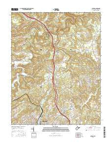
Clarksburg, West Virginia, USGS topographic map dated 1949.
Includes geographic coordinates (latitude and longitude). This topographic map is suitable for hiking, camping, and exploring, or framing it as a wall map.
Printed on-demand using high resolution imagery, on heavy weight and acid free paper, or alternatively on a variety of synthetic materials.
Topos available on paper, Waterproof, Poly, or Tyvek. Usually shipping rolled, unless combined with other folded maps in one order.
- Product Number: USGS-5416210
- Free digital map download (high-resolution, GeoPDF): Clarksburg, West Virginia (file size: 15 MB)
- Map Size: please refer to the dimensions of the GeoPDF map above
- Weight (paper map): ca. 55 grams
- Map Type: POD USGS Topographic Map
- Map Series: HTMC
- Map Verison: Historical
- Cell ID: 68718
- Scan ID: 701711
- Imprint Year: 1949
- Woodland Tint: Yes
- Aerial Photo Year: 1943
- Datum: NAD27
- Map Projection: Transverse Mercator
- Shaded Relief map: Yes
- Map published by United States Army
- Map Language: English
- Scanner Resolution: 508 dpi
- Map Cell Name: Clarksburg
- Grid size: 1 X 2 Degree
- Date on map: 1949
- Map Scale: 1:250000
- Geographical region: West Virginia, United States
Neighboring Maps:
All neighboring USGS topo maps are available for sale online at a variety of scales.
Spatial coverage:
Topo map Clarksburg, West Virginia, covers the geographical area associated the following places:
- Crows Mills - Circle Heights - Miletus - Morris Mobile Home Park (historical) - Sharpsburg - Marrtown - Freeland - Low Gap - Crestview Park - Alum Bridge - Kausooth - Montpelier - Boaz - Willard - Maple Lake - Kelsey (historical) - South Hills Estates - Confederate Crossroads (historical) - Pinecrest Addition - Kidwell - Rees Mill - Calais - Rich Hill (historical) - West - Ashley - Booher - Lincolnshire - Beulah Hill - Cusicks Crossing - Cluster - Seeleyburg (historical) - Palestine - Lowsville - Swazey - Washington Gardens - Pierce (historical) - Parkersburg - New Concord - Five Points - Ashton - Brant Hill - Community Acres - Onie (historical) - Willow Lakes - Whipple - Horner - Norwood - Avondale - Park View - Bridgeway - Larkmead - Marr - Deep Valley - White Oak - Fairway Acres - Sun Valley - McGary - Roberts - Dalzell - Custer Addition - Ashtree - Hopewell - Deep Valley - Cool Springs - Haleville - Big Run - Howard (historical) - West Union - Wind Ridge - Teagarden Homes - Bonn - Rockport (historical) - Briggs - Katy - Reader - Chaplin - Durbin - Earnshaw - Shady Brook - Eva - Weekleys (historical) - Cloud (historical) - Pedlar - Veto - Hoyt - Moundsville - Iuka - Vadis - Middle Point - Bridgeville - Mace Addition - Lashley - Denver Heights - Wadestown - Long Run - Morganville - Central - Carbide - Meadowdale - Chesterhill
- Map Area ID: AREA4039-82-80
- Northwest corner Lat/Long code: USGSNW40-82
- Northeast corner Lat/Long code: USGSNE40-80
- Southwest corner Lat/Long code: USGSSW39-82
- Southeast corner Lat/Long code: USGSSE39-80
- Northern map edge Latitude: 40
- Southern map edge Latitude: 39
- Western map edge Longitude: -82
- Eastern map edge Longitude: -80

