
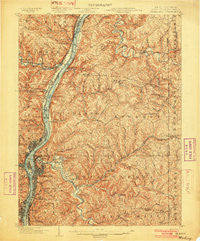
~ Wheeling WV topo map, 1:62500 scale, 15 X 15 Minute, Historical, 1902
Wheeling, West Virginia, USGS topographic map dated 1902.
Includes geographic coordinates (latitude and longitude). This topographic map is suitable for hiking, camping, and exploring, or framing it as a wall map.
Printed on-demand using high resolution imagery, on heavy weight and acid free paper, or alternatively on a variety of synthetic materials.
Topos available on paper, Waterproof, Poly, or Tyvek. Usually shipping rolled, unless combined with other folded maps in one order.
- Product Number: USGS-5416040
- Free digital map download (high-resolution, GeoPDF): Wheeling, West Virginia (file size: 14 MB)
- Map Size: please refer to the dimensions of the GeoPDF map above
- Weight (paper map): ca. 55 grams
- Map Type: POD USGS Topographic Map
- Map Series: HTMC
- Map Verison: Historical
- Cell ID: 64458
- Scan ID: 253920
- Survey Year: 1901
- Datum: Unstated
- Map Projection: Unstated
- Map published by United States Geological Survey
- Map Language: English
- Scanner Resolution: 600 dpi
- Map Cell Name: Wheeling
- Grid size: 15 X 15 Minute
- Date on map: 1902
- Map Scale: 1:62500
- Geographical region: West Virginia, United States
Neighboring Maps:
All neighboring USGS topo maps are available for sale online at a variety of scales.
Spatial coverage:
Topo map Wheeling, West Virginia, covers the geographical area associated the following places:
- Wilson (historical) - Salt Run - Valley Camp - Elm Terrace - Parkview - Aetnaville - Benwood - Eden - Leatherwood - Jackson Heights - Upper Benwood - Short Creek - Elm Grove - Riverview - Dallas - Warrenton - East Wheeling - Beham - Glen Robbins - Bridgeport - Glenwood - Potomac - Hopewell - Roneys Point - Mount Olivet - Glenns Run (historical) - Bethlehem - Greggsville - Mill Acres - Windsor Heights - North Island - Springdale - Yorkville - Rush Run - Winifred Knoll - Valley Grove - Power - West Liberty - Oakmont Hills - Mount de Chantal - Mount Echo - Glenndale (historical) - Clearview - Highland City - Grandview Heights - Jug Run - Terminal Junction - Florence - West Wheeling - Warwood Terrace - Allendale - Bellaire - Upland Heights - Willow Springs (historical) - Dunsfort - Clinton - Echo Point - Hawthorne Court - South Island - Pettit Heights - Triadelphia - Connorville - Martins Ferry - Benwood Junction - Beech Bottom - Frogtown - Tiltonsville - Wheeling Heights - Warwood - Glen Run - West Alexander - Rayland - North Wheeling - North Park - South Wheeling - Shannon (historical) - McCulley Estates - Wolf Estates - Forest Hills - Woodsdale - Dawn Ree Acres - Leewood Park - Mozart - Bethany - Pleasant Valley - Twilight - Stringer - McKinleyville - Edgewood - Connor - Mozart Meadows - Oakmont - Lombardy Heights - Wildwood Acres - Fulton - Bowman (historical) - Betty Zane - Vineyard Hills - Cedar Rocks - Wheeling
- Map Area ID: AREA40.2540-80.75-80.5
- Northwest corner Lat/Long code: USGSNW40.25-80.75
- Northeast corner Lat/Long code: USGSNE40.25-80.5
- Southwest corner Lat/Long code: USGSSW40-80.75
- Southeast corner Lat/Long code: USGSSE40-80.5
- Northern map edge Latitude: 40.25
- Southern map edge Latitude: 40
- Western map edge Longitude: -80.75
- Eastern map edge Longitude: -80.5


