
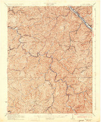
~ Peytona WV topo map, 1:62500 scale, 15 X 15 Minute, Historical, 1931
Peytona, West Virginia, USGS topographic map dated 1931.
Includes geographic coordinates (latitude and longitude). This topographic map is suitable for hiking, camping, and exploring, or framing it as a wall map.
Printed on-demand using high resolution imagery, on heavy weight and acid free paper, or alternatively on a variety of synthetic materials.
Topos available on paper, Waterproof, Poly, or Tyvek. Usually shipping rolled, unless combined with other folded maps in one order.
- Product Number: USGS-5415760
- Free digital map download (high-resolution, GeoPDF): Peytona, West Virginia (file size: 13 MB)
- Map Size: please refer to the dimensions of the GeoPDF map above
- Weight (paper map): ca. 55 grams
- Map Type: POD USGS Topographic Map
- Map Series: HTMC
- Map Verison: Historical
- Cell ID: 60926
- Scan ID: 253782
- Survey Year: 1909
- Datum: NAD
- Map Projection: Polyconic
- Map published by United States Geological Survey
- Map Language: English
- Scanner Resolution: 600 dpi
- Map Cell Name: Peytona
- Grid size: 15 X 15 Minute
- Date on map: 1931
- Map Scale: 1:62500
- Geographical region: West Virginia, United States
Neighboring Maps:
All neighboring USGS topo maps are available for sale online at a variety of scales.
Spatial coverage:
Topo map Peytona, West Virginia, covers the geographical area associated the following places:
- Dartmont - Ashford - Nellis - Racine - Prenter - Milltown - Seth - Chesapeake - Maxine - Bloomingrose - Eden - Fosterville - Joes Creek - Winifrede Junction - Easly - Hernshaw - Cabot - Winifrede - Diamond - Andrew - Mount Hope - Olcott - Brushton - Keith - Lico - Hopkins Fork - Sterling (historical) - Witcher - Coopertown - Johns - Bradley - Dickinson - Comfort - Grippe - Orgas - Williams Mountain - Belle - Kirbyton - Peytona - Rumble - Sylvester - Dungriff - Sharlow - Marmet - Nelson
- Map Area ID: AREA38.2538-81.75-81.5
- Northwest corner Lat/Long code: USGSNW38.25-81.75
- Northeast corner Lat/Long code: USGSNE38.25-81.5
- Southwest corner Lat/Long code: USGSSW38-81.75
- Southeast corner Lat/Long code: USGSSE38-81.5
- Northern map edge Latitude: 38.25
- Southern map edge Latitude: 38
- Western map edge Longitude: -81.75
- Eastern map edge Longitude: -81.5


