
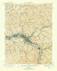
~ Charleston WV topo map, 1:62500 scale, 15 X 15 Minute, Historical, 1931, updated 1956
Charleston, West Virginia, USGS topographic map dated 1931.
Includes geographic coordinates (latitude and longitude). This topographic map is suitable for hiking, camping, and exploring, or framing it as a wall map.
Printed on-demand using high resolution imagery, on heavy weight and acid free paper, or alternatively on a variety of synthetic materials.
Topos available on paper, Waterproof, Poly, or Tyvek. Usually shipping rolled, unless combined with other folded maps in one order.
- Product Number: USGS-5415090
- Free digital map download (high-resolution, GeoPDF): Charleston, West Virginia (file size: 12 MB)
- Map Size: please refer to the dimensions of the GeoPDF map above
- Weight (paper map): ca. 55 grams
- Map Type: POD USGS Topographic Map
- Map Series: HTMC
- Map Verison: Historical
- Cell ID: 52416
- Scan ID: 253427
- Imprint Year: 1956
- Survey Year: 1907
- Datum: NAD27
- Map Projection: Polyconic
- Map published by United States Geological Survey
- Map Language: English
- Scanner Resolution: 600 dpi
- Map Cell Name: Charleston
- Grid size: 15 X 15 Minute
- Date on map: 1931
- Map Scale: 1:62500
- Geographical region: West Virginia, United States
Neighboring Maps:
All neighboring USGS topo maps are available for sale online at a variety of scales.
Spatial coverage:
Topo map Charleston, West Virginia, covers the geographical area associated the following places:
- Sandy - Edgewood - Big Chimney - Forest Hills - Blackhawk - Rock Lake Village - North Charleston - Loudendale - South Malden - Dunbar - Riverview - Dupont City - Creed - Hillsdale - Bream - Twomile - Guthrie - Coal Fork - Kanawha Estates - Elk Hills - Lower Belle - Ruth - Airport Village - Elk Forest - Mink (historical) - Lanham - Oakwood - South Charleston - Snow Hill - Mound (historical) - Milliken - Wallace - Malden - Kanawha City - Etowah - Elk - Charleston - Loudon Heights - Spring Hill - South Park - Pocatalico - Wilson - South Hills - Davis Creek - Fort Hill - Barlow (historical) - South Ruffner - Villa (historical) - Kenna Homes - Ivydale - Edgewood Acres - Copenhaver (historical) - Joplin - East Side - Meadowbrook - Rocky Fork - Tyler Mountain - Knollwood - Rand - Aarons - West Side - Port Amherst - Ruthdale - Vandalia - Weberwood - Rutledge - Legg
- Map Area ID: AREA38.538.25-81.75-81.5
- Northwest corner Lat/Long code: USGSNW38.5-81.75
- Northeast corner Lat/Long code: USGSNE38.5-81.5
- Southwest corner Lat/Long code: USGSSW38.25-81.75
- Southeast corner Lat/Long code: USGSSE38.25-81.5
- Northern map edge Latitude: 38.5
- Southern map edge Latitude: 38.25
- Western map edge Longitude: -81.75
- Eastern map edge Longitude: -81.5


