
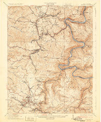
~ Beckley WV topo map, 1:62500 scale, 15 X 15 Minute, Historical, 1932
Beckley, West Virginia, USGS topographic map dated 1932.
Includes geographic coordinates (latitude and longitude). This topographic map is suitable for hiking, camping, and exploring, or framing it as a wall map.
Printed on-demand using high resolution imagery, on heavy weight and acid free paper, or alternatively on a variety of synthetic materials.
Topos available on paper, Waterproof, Poly, or Tyvek. Usually shipping rolled, unless combined with other folded maps in one order.
- Product Number: USGS-5414916
- Free digital map download (high-resolution, GeoPDF): Beckley, West Virginia (file size: 11 MB)
- Map Size: please refer to the dimensions of the GeoPDF map above
- Weight (paper map): ca. 55 grams
- Map Type: POD USGS Topographic Map
- Map Series: HTMC
- Map Verison: Historical
- Cell ID: 51090
- Scan ID: 253332
- Edit Year: 1929
- Survey Year: 1911
- Datum: NAD
- Map Projection: Polyconic
- Map published by United States Geological Survey
- Map Language: English
- Scanner Resolution: 600 dpi
- Map Cell Name: Beckley
- Grid size: 15 X 15 Minute
- Date on map: 1932
- Map Scale: 1:62500
- Geographical region: West Virginia, United States
Neighboring Maps:
All neighboring USGS topo maps are available for sale online at a variety of scales.
Spatial coverage:
Topo map Beckley, West Virginia, covers the geographical area associated the following places:
- Prince - Newtown - Bradley - Newlyn - Piney View - Fire Creek (historical) - Claremont - Beckley Junction - Prudence - Packs Branch - Beckley - Oswald (historical) - Whipple - Greenstown - Ogden - Johnstown - MacArthur - Hamlet (historical) - Kilsyth - Dimmock - Ephram (historical) - Thayer - Grandview - Erskine (historical) - Alaska (historical) - Sprague - Prosperity - East Sewell (historical) - Wright - Cabell - Glade - Glen Morgan - James Crest Farms - Cranberry - Sylvia (historical) - Warden - Oak Hill Junction - Tamroy (historical) - Finlow (historical) - Stonewall (historical) - Norvell (historical) - Bowlin - Riley - Turkey Knob - Sewell - Harvey - Price Hill - Hilltop - Dunloup - East Beckley - Beury - Wickham - Sun - Royal - Rocklick - Whorley (historical) - Skelton - Rodes (historical) - Thurmond - Macdonald - McKendree - Raleigh - Rosedale - Concho - Dry Hill - Export (historical) - Pine Hills - Redstar - Pennbrook (historical) - Old Mill Village - Whipple Junction - Sanger - Mount Tabor - Maple Fork - White Stick (historical) - Harper Heights - Wingrove - Meadow Fork - Mabscott - Red Ash (historical) - Quinnimont - Morgan Hills - Terry Junction - Derryhale - Oak Hill - Crow - Bays Heights - Minden - Terry - Stanaford - Brooklyn - Pinepoca (historical) - Glen Jean - Mount Hope - Lanark - Scarbro - White Oak Junction - Clifftop - Rush Run (historical) - Salem
- Map Area ID: AREA3837.75-81.25-81
- Northwest corner Lat/Long code: USGSNW38-81.25
- Northeast corner Lat/Long code: USGSNE38-81
- Southwest corner Lat/Long code: USGSSW37.75-81.25
- Southeast corner Lat/Long code: USGSSE37.75-81
- Northern map edge Latitude: 38
- Southern map edge Latitude: 37.75
- Western map edge Longitude: -81.25
- Eastern map edge Longitude: -81


